Wentworth in Rockingham County, North Carolina — The American South (South Atlantic)
Wentworth and the War
Confederate Infantry Companies Form
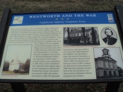
When the Civil War began in 1861, the courthouse village of Wentworth contained a few hundred people as well as county buildings, law offices, several stores, two churches, two hotels, a school, a Masonic Hall, a tavern, a carriage factory, and two tobacco factories. Several of these buildings still stand. They include the law office constructed about 1856 for three attorneys – Thomas Settle, Jr., Thomas Ruffin, Jr., and John H. Dillard – each of whom served as Confederate army officers and later as justices of the North Carolina Supreme Court. Postmaster Thomas A. Ratliffe’s store, built about 1859, served as a Confederate post office throughout the war. Wright Tavern was the site of a riot in 1864 when Gov. Zebulon D. Vance and Thomas Settle, Jr., a former Unionist, attempted to give speeches. Wentworth Methodist Church was organized in 1836, and the present sanctuary was constructed in 1859. Also in 1859, Confederate Gen. Alfred M. Scales helped organize the congregation of Wentworth Presbyterian Church. The church was erected in 1860, after Scales moved here in 1859. The Reynolds-Gunn House, built about 1858 by Col. James Irvin (69th Regiment State Militia), was later Scales’ home. He moved to Greensboro in 1873 and served as governor from 1884 to 1889. The present courthouse was built in 1907 to replace the 1824 structure that burned in 1906. Secession meetings had been held in the old courthouse, and there several Confederate infantry companies were formed.
Erected by North Carolina Civil War Trails.
Topics and series. This historical marker is listed in this topic list: War, US Civil. In addition, it is included in the North Carolina Civil War Trails series list. A significant historical year for this entry is 1861.
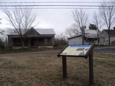
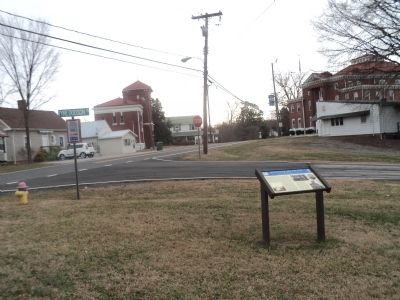
Location. 36° 23.931′ N, 79° 46.3′ W. Marker is in Wentworth, North Carolina, in Rockingham County. Marker is at the intersection of State Highway 65 and Tyre Dodson Road, on the right when traveling east on State Highway 65. Touch for map. Marker is in this post office area: Wentworth NC 27375, United States of America. Touch for directions.
Other nearby markers. At least 8 other markers are within 6 miles of this marker, measured as the crow flies. Wright Tavern (about 400 feet away, measured in a direct line); Wentworth Methodist Church (approx. 0.3 miles away); a different marker also named Wentworth Methodist Church (approx. 0.4 miles away); Glenn T. Settle (approx. 2.7 miles away); Thomas Settle, Jr. (approx. 3.4 miles away); Stephen A. Douglas (approx. 4.8 miles away); Lower Saura Town (approx. 5.1 miles away); Speedwell Church (approx. 6 miles away). Touch for a list and map of all markers in Wentworth.
More about this marker. A portrait of Thomas Settle, Jr. appears at the top right of the marker. Elsewhere are photographs of the Wentworth Presbyterian Church, the Wright Tavern and the Rockingham County Court House.
Credits. This page was last revised on June 16, 2016. It was originally submitted on February 6, 2013, by Bill Coughlin of Woodland Park, New Jersey. This page has been viewed 616 times since then and 34 times this year. Photos: 1, 2, 3. submitted on February 6, 2013, by Bill Coughlin of Woodland Park, New Jersey.


