Near Nancy in Pulaski County, Kentucky — The American South (East South Central)
The Ravine
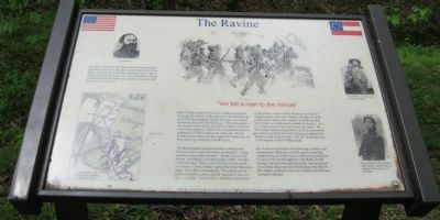
Colonel Speed Fry (photo inset)
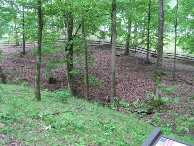
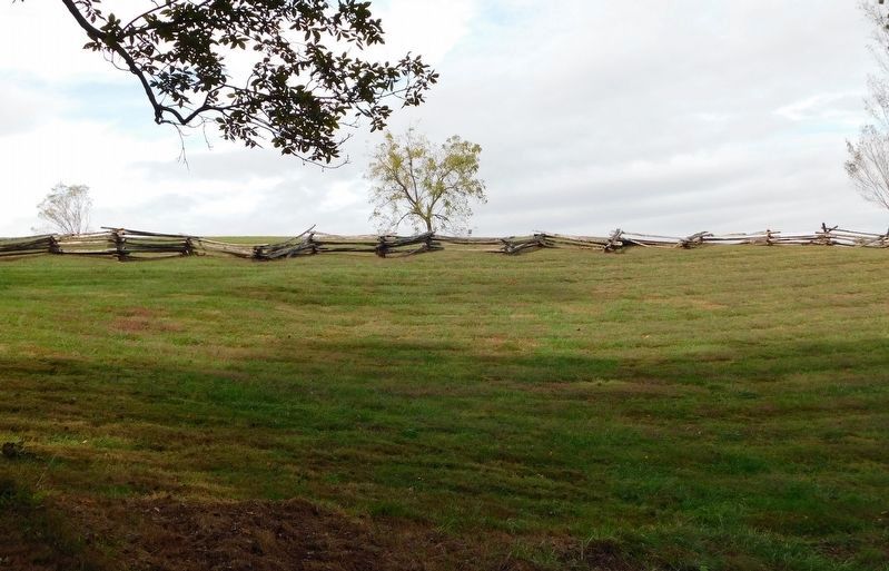
For much of the battle the Union defense line was behind a rail fence at the top of the hill. Colonel Speed Fry of the Union 4th Kentucky said that his men there came "under a galling fire from the enemy, who were concealed in a deep ravine at the foot of the hill and posted on the opposite hill, distant about 250 yards."
"We Fell a Man to the Minute"
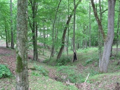
The 15th Mississippi was the first Confederate regiment to engage the Federal soldiers posted on the Mill Springs road. The Mississippians tried to flush the Union forces by moving down the hill behind you. When they came to the ravine in front of you, they were not able to cross because of its steepness. There were considerable delays in getting the 15th Mississippi to the other side. This allowed the Union force to take up position behind the rail fence at the top of the hill in front of you.
The Mississippians charged forward "with bayonets fixed and their large cane-knives unsheathed."Union gunfire dropped many of them. "We fell a man to the minute" according to one Mississippi soldier. Another wrote later that, "Some of the best blood in the south went down." Union artillery opened fire on the Mississippians. One officer remembered, "The enemy ran out pieces of artillery almost directly opposite to our center ... I called, 'Look out boys.' And threw myself, first on the ground. I had scarcely hit the ground before a charge of grape shot came whizzing through our ranks and seemed to almost lift Company D off the ground. Several men were killed and wounded by that fire. As I lay on the ground, a man fell across each arm." The Mississippi regiment stopped for a while, but pressed on toward the top of the hill when Union men appeared to fall back away from the fence. The 20th Tennessee came to the support of the 15th Mississippi.
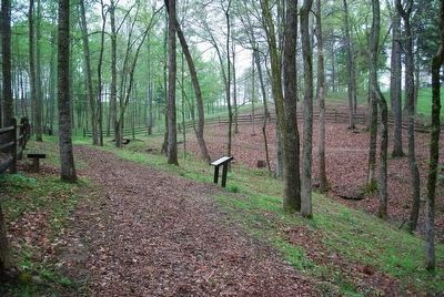
The ravine both protected the Mississippi soldiers and trapped them. When they were forced to retreat they found getting out of the ravine as difficult as getting into it. Some of the hardest fighting of the Battle of Mill Springs took place through this ravine. Archaeological excavations turned up sixty fired bullets in the area of this marker, evidence of the rain of bullets that fell here during the fighting.
Erected by Mill Springs Battlefield Association.
Topics. This historical marker is listed in this topic list: War, US Civil.
Location. 37° 3.358′ N, 84° 44.233′ W. Marker is near Nancy, Kentucky, in Pulaski County. Marker can be reached from State Road 235, 0.1 miles south of State Road 761, on the left when traveling south. Marker is Station 8 on the Battlefield Loop Trail at Tour Stop 2 - Zollicoffer Park. See photo of trail map. The marker is in forest and the location was estimated using Bing Maps (this marker may be visible). Touch for map. Marker is in this post office area: Nancy KY 42544, United States of America. Touch for directions.
Other nearby markers. At least 8 other markers are within walking distance of this marker. Archaeology and the Mill Springs Battlefield (a few steps from this marker); The Blacksmith Shop (within shouting distance of this marker); Balie Peyton, Jr. (1833-1862) (about 400 feet away, measured in a direct line); Confederate Mass Grave Memorial (about 600 feet away); Confederate Retreat (about 600 feet away); Confederate Dead (about 600 feet away); "Confederate Mass Grave" (about 600 feet away); Dawn of Battle (about 600 feet away). Touch for a list and map of all markers in Nancy.
More about this marker. This marker has the following illustrations: Photograph of Colonel Speed Fry, Battle map showing location of the marker, sketch of Confederates charging, photographs of Private Charles C. Frierson, 15th Mississippi Infantry, and Corporal William F. Hoch, 4th Kentucky Infantry (shown later, as a captain) - photo courtesy of USAMHI.
Also see . . . Battle of Mills Spring. Wikipedia entry (Submitted on October 30, 2022, by Larry Gertner of New York, New York.)
Credits. This page was last revised on November 1, 2022. It was originally submitted on February 7, 2013, by David Graff of Halifax, Nova Scotia. This page has been viewed 500 times since then and 17 times this year. Photos: 1. submitted on February 7, 2013, by David Graff of Halifax, Nova Scotia. 2. submitted on September 16, 2015, by Brandon Fletcher of Chattanooga, Tennessee. 3, 4. submitted on February 7, 2013, by David Graff of Halifax, Nova Scotia. 5. submitted on March 6, 2021, by Bradley Owen of Morgantown, West Virginia. • Craig Swain was the editor who published this page.
