Monterey in Monterey County, California — The American West (Pacific Coastal)
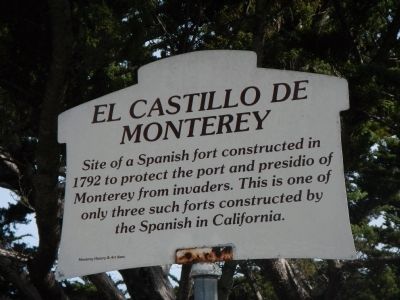
El Castillo de Monterey
Erected by Monterey History & Art Association.
Topics. This historical marker is listed in this topic list: Forts and Castles. A significant historical year for this entry is 1792.
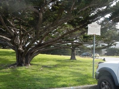
Location. 36° 36.365′ N, 121° 53.748′ W. Marker is in Monterey, California, in Monterey County. Marker can be reached from Corporal Ewing Road. This marker is located in the Presidio de Monterey to the east of Corporal Ewing Road on a small knoll overlooking Monterey Bay. Touch for map. Marker is in this post office area: Monterey CA 93944, United States of America. Touch for directions.
Other nearby markers. At least 8 other markers are within walking distance of this marker. The Argentine Navy (a few steps from this marker); El Castillo Site (within shouting distance of this marker); Here ... landed Very Rev. Father Junipero Serra (within shouting distance of this marker); Presidio of Monterey Museum (about 400 feet away, measured in a direct line); Don Gaspar de Portolá (about 600 feet away); 400th Anniversary of the Naming of Monterey Bay by Gen. Sebastián Vizcaíno (about 700 feet away); Sloat Monument (about 700 feet away); Fort Mervine (about 800 feet away). Touch for a list and map of all markers in Monterey.
Also see . . . Posts at Monterey. El Castillo (1792-1846), the fort of the first presidio at Monterey, began as an open V shaped parapet of logs and adobe revetments enclosing a small wooden barracks. Adobe structures were added later. From 1792 to 1822, this fort was the castillio, or fortification, for the Spanish presidio. (Submitted on February 8, 2013, by Barry Swackhamer of Brentwood, California.)
Credits. This page was last revised on June 16, 2016. It was originally submitted on February 8, 2013, by Barry Swackhamer of Brentwood, California. This page has been viewed 659 times since then and 22 times this year. Photos: 1, 2. submitted on February 8, 2013, by Barry Swackhamer of Brentwood, California. • Syd Whittle was the editor who published this page.

