Sunny Valley in Josephine County, Oregon — The American West (Northwest)
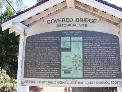
Grave Creek Ranch
1851 - 1918
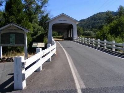
— Grave Creek Covered Bridge Historical Site —
In the fall of 1846, the first emigrant train from Fort Hall, Idaho, to travel the southern route to the Williamette Valley camped on the north side of this creek, the Woodpile creek. Martha Leland Crowley, 16 years old died of Typhoid fever during this encampment and was buried one-hundred fifty feet north of the creek on the east side of a white oak tree that was later removed for the present roadway, thus the name Grave Creek.
When James H. Twogood laid out his land claim in the fall of 1851 and filed on it May 1, 1852, he named it the Grave Creek Ranch in memory of that unfortunate incident.
McDonough Harkness, his partner, was the first postmaster of Josephine County in the newly named town of Leland on March 28, 1855. Harkness was killed by Indians in April 1856 while riding dispatch for the Army during the second Indian War of southern Oregon which started in October of 1855.
A stockade was built around a log wayside and the hotel building at Leland. The small town was gateway to the lower Rogue country where Indians retreated so it became the gathering point of a large force of regular army and volunteers and was known as Fort Leland.
A major encounter of the war took place some 8 miles west of the Fort known as the Battle of Hungry Hill. This ill-fated engagement produced some 37 dead, wounded and missing. Some of these soldiers were buried north of the Fort at the corner of the present Leland road and old Pacific highway.
The last remnants of old Leland are the 3 large maple trees to the north on the east side of the road & the Ft. Leland rocklined well on the west side of the road both on private property.
In 1860 the Grave Creek Ranch became an overland stage stop for the California Oregon Stage Line. A new hotel known as the Grave House #2 was built and operated until it burned down in Dec. of 1875. A nearby farmhouse was enlarged enough to accommodate the stage company and was known as the Grave Creek House #3 or Harkness Inn. President Hayes, his wife and entourage spent the night here on September 28, 1880.
Erected by Josephine County Public Works and Josephine County Historical Society.
Topics and series. This historical marker is listed in these topic lists: Bridges & Viaducts • Settlements & Settlers • Wars, US Indian. In addition, it is included in the Covered Bridges, and the Former U.S. Presidents: #19 Rutherford B. Hayes series lists. A significant historical month for this entry is March 1865.
Location. 42° 38.16′ N, 123° 22.656′ W. Marker is in Sunny Valley, Oregon, in Josephine County. Marker is on Sunny Valley Loop south of Placer Road. Touch for map. Marker is in this post office area: Wolf Creek OR 97497, United States of America. Touch for directions.
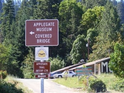
Other nearby markers. At least 8 other markers are within 5 miles of this marker, measured as the crow flies. The Applegate Trail (here, next to this marker); Applegate Trail - Grave Creek (within shouting distance of this marker); a different marker also named The Applegate Trail (about 800 feet away, measured in a direct line); "Grave Creek" (about 800 feet away); Golden (approx. 3.9 miles away); GOLD! (approx. 4 miles away); Wolf Creek Tavern (approx. 4.2 miles away); Feeble, Hungry, and Haggard (approx. 4.2 miles away).
Credits. This page was last revised on June 16, 2016. It was originally submitted on February 9, 2013, by Don Morfe of Baltimore, Maryland. This page has been viewed 966 times since then and 49 times this year. Photos: 1, 2, 3. submitted on February 9, 2013, by Don Morfe of Baltimore, Maryland. • Syd Whittle was the editor who published this page.


