Atoka in Tipton County, Tennessee — The American South (East South Central)
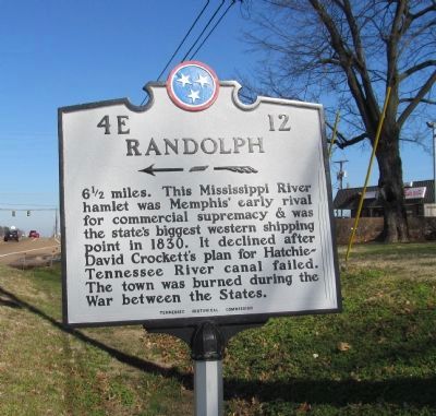
Randolph
Erected by Tennessee Historical Commission. (Marker Number 4E 12.)
Topics and series. This historical marker is listed in these topic lists: Settlements & Settlers • War, US Civil. In addition, it is included in the Tennessee Historical Commission series list. A significant historical year for this entry is 1830.
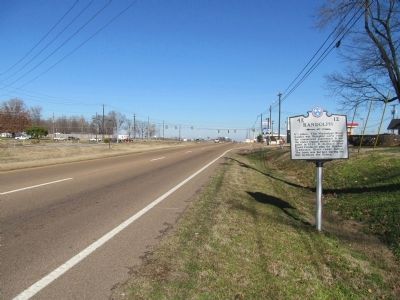
Location. 35° 26.59′ N, 89° 47.401′ W. Marker is in Atoka, Tennessee, in Tipton County. Marker is on U.S. 51, 0.1 miles north of Kimbrough Drive, on the right when traveling north. Touch for map. Marker is in this post office area: Atoka TN 38004, United States of America. Touch for directions.
Other nearby markers. At least 8 other markers are within 5 miles of this marker, measured as the crow flies. Atoka Evangelical Presbyterian Church (approx. 0.9 miles away); Mt. Zion — Munford (approx. 1.4 miles away); Munford United Methodist Church (approx. 1½ miles away); Salem Associate Reformed Presbyterian Church (approx. 3.1 miles away); Anthony Chapel School, Greenwood AME Church & Cemetery (approx. 4.6 miles away); Tipton County Confederate Reunion (approx. 4.7 miles away); Hurst's Raid at Barretville (approx. 5.1 miles away); Bobby Blue Bland (approx. 5.1 miles away). Touch for a list and map of all markers in Atoka.
Credits. This page was last revised on June 16, 2016. It was originally submitted on February 9, 2013, by Judith Barber of Marietta, Georgia. This page has been viewed 488 times since then and 17 times this year. Photos: 1, 2. submitted on February 9, 2013, by Judith Barber of Marietta, Georgia. • Bernard Fisher was the editor who published this page.

