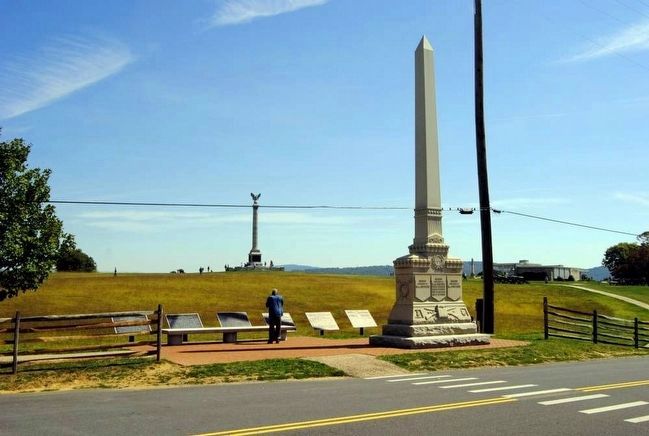
Near Sharpsburg in Washington County, Maryland — The American Northeast (Mid-Atlantic)
Second Army Corps
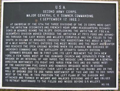
Second Army Corps.
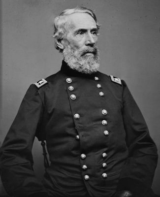
Major General E.V. Sumner, Commanding.
(September 17, 1862.)
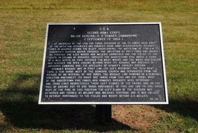
At daybreak of the 17th the three divisions of the 2d Corps were east of the Antietam: Sedgwick's Division moved, crossed the Antietam at Pry's Ford and, advancing through the East Woods and Miller's Cornfield and the fields to the south, in column of brigades, crossed the Hagerstown Pike about a third of a mile north of this, entered the West Woods, and the right and center had reached the open ground beyond, when its advance was checked by Jackson's Command and the artillery of Stuart's Cavalry Division.
Gorman's Brigade was in first line, its left regiment, the 34th New York, a few yards west of the Dunkard Church and separated from the brigade by an interval of 940 yards from this and 610 yards west of the Hagerstown Pike. Dana's and Howard's Brigades were in second and third lines respectively. Their left flanks in the ravine and on the roll of ground 200 to 250 yards northwest of this and 280 to 300 yards west of the pike. In this position the left flank of the division was attacked and turned by McLaws' and Walker's Divisions and it was obliged to retreat northward to the fields and woods beyond D.R. Miller's.
(Second, continuation, tablet):
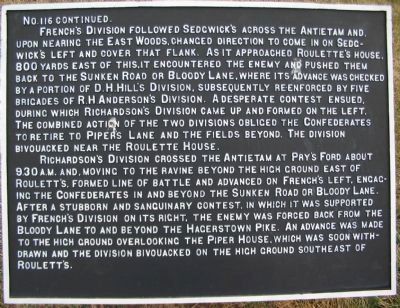
No. 116 Continued.
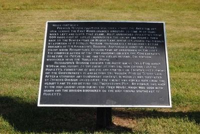
French's Division followed Sedgwick's across the Antietam and upon nearing the East Woods, changed direction to come in on Sedgwick's left and cover that flank. As it appoached Roulette's house, 800 yards east of this, it encountered the enemy and pushed them back to the Sunken Road or Bloody Lane, where its advance was checked by a portion of D.H. Hill's Division. A desperate contest ensued, during which Richardson's Division came up and formed on the left. The combined action of the two divisions obliged the Confederates to retire to Piper's Lane and the fields beyond. The Division bivouacked near the Roulette House.
Richardson's Division crossed the Antietam at Pry's Ford about 9:30 a.m. and, moving to the ravine beyond the high ground east of Roulett's, formed line of battle and advanced on French's left, engaging the Confederates in and beyond the Sunken Road or Bloody Lane. After a stubborn and sanguinary contest, in which it was supported by French's Division on its right, the enemy was forced back from the Bloody Lane to and beyond the Hagerstown Pike. An advance was made to the high ground overlooking the Piper House, which was soon withdrawn and the division bivouacked on the high ground southeast of Roulett's.
Erected by Antietam Battlefield Board. (Marker Number 116.)
Topics and series. This historical marker is listed
in this topic list: War, US Civil. In addition, it is included in the Antietam Campaign War Department Markers series list. A significant historical year for this entry is 1862.
Location. 39° 28.526′ N, 77° 44.782′ W. Marker is near Sharpsburg, Maryland, in Washington County. Marker is at the intersection of Dunker Church Road / Old Hagerstown Pike and Smoketown Road, on the right when traveling north on Dunker Church Road / Old Hagerstown Pike. Located at stop one of the driving tour of Antietam Battlefield, across the road from the Dunker Church in a tablet cluster. Touch for map. Marker is in this post office area: Sharpsburg MD 21782, United States of America. Touch for directions.
Other nearby markers. At least 8 other markers are within walking distance of this marker. Twelfth Army Corps (here, next to this marker); a different marker also named Twelfth Army Corps (here, next to this marker); Greene's Division, Twelfth Army Corps (here, next to this marker); Reserve Artillery, Longstreet's Command (here, next to this marker); 5th, 7th and 66th Ohio Infantry Monument (a few steps from this marker); Dunkard Church (within shouting distance of this marker); Destroy the Rebel Army (within shouting distance of this marker); a different marker also named "Destroy the Rebel Army" (within shouting distance of this marker). Touch for a list and map of all markers in Sharpsburg.
Also see . . .
1. Antietam Battlefield. National Park Service site. (Submitted on March 17, 2008, by Craig Swain of Leesburg, Virginia.)
2. Sumner's Corps. Command of the Second Corps was the height of Sumner's 44 year military career. He served as a Major General at Antietam. Sumner died the following March awaiting reassignment to the Western Theater. (Submitted on March 17, 2008, by Craig Swain of Leesburg, Virginia.)
3. Edwin Vose Sumner. Edwin Vose Sumner (January 30, 1797 – March 21, 1863) was a career United States Army officer who became a Union Army general and the oldest field commander of any Army Corps on either side during the American Civil War. (Submitted on October 15, 2015, by Brian Scott of Anderson, South Carolina.)
Photographed By Craig Swain
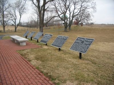
5. Tablet Cluster Opposite the Dunker Church
Five numbered tablets, with one continuation tablet, stand in front of the Dunker Church on the east side of the old Pike. These are, from furthest from the camera, Tyndale's Brigade (53), Second Army Corps (116), continuation tablet for 116, Goodrich's Brigade (114), Greene's Division (51), and Reserve Artillery of Longstreet's Command (306).
Brady Collection, National Portrait Gallery
7. Major General Edwin Vose Sumner (1797–1863)
In the fall of 1862, at the Battle of Antietam, Sumner was the center of controversy for ordering Brig. Gen. John Sedgwick's division to launch an attack into the West Woods on the morning of the battle. The assault was devastated by a Confederate counterattack, and Sedgwick's men were forced to retreat in great disorder to their starting point with over 2,200 casualties.
Photographed By Craig Swain, September 17, 2007
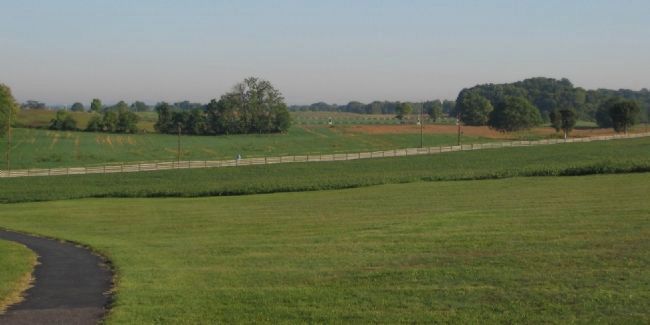
8. Sedgwick's Advance
Looking from the New York State Monument to the north. The closest rail fence is the Smoketown Road. Beyond that are the fields south of the Cornfield. Cornfield Avenue runs left to right, with the monuments along the route seen in the distance. Sedgwick's Division advanced between the Smoketown Road and the south edge of the Cornfield (approximately the path of the modern Cornfield Avenue).
Credits. This page was last revised on November 24, 2017. It was originally submitted on March 17, 2008, by Craig Swain of Leesburg, Virginia. This page has been viewed 937 times since then and 14 times this year. Photos: 1, 2. submitted on March 17, 2008, by Craig Swain of Leesburg, Virginia. 3, 4. submitted on October 15, 2015, by Brian Scott of Anderson, South Carolina. 5. submitted on March 16, 2008, by Craig Swain of Leesburg, Virginia. 6, 7. submitted on October 15, 2015, by Brian Scott of Anderson, South Carolina. 8. submitted on March 17, 2008, by Craig Swain of Leesburg, Virginia.
