Pittsburg Landing near Shiloh in Hardin County, Tennessee — The American South (East South Central)
Pittsburg Landing
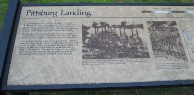
On Sunday afternoon thousands of Union stragglers congregated along the banks here and refused to fight, while reports of disaster filtered in from the battlefield.
Late Sunday afternoon the tide began to turn. Cheers went up when the first Union reinforcements appeared on the opposite shore. Throughout the night, additional troops poured into the landing by steamboat and by road — 24,000 in all. The next morning the revitalized Union forces won back all the ground they had lost, and sent the Confederates reeling back to Corinth.
Erected by National Park Service.
Topics. This historical marker is listed in this topic list: War, US Civil.
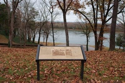
Location. 35° 8.959′ N, 88° 19.18′ W. Marker is near Shiloh, Tennessee, in Hardin County. It is in Pittsburg Landing. Marker is on Riverside Drive/Dill Branch Road, 0.2 miles south of Pittsburg Landing Road, on the left when traveling south. The marker is at Stop 20 of the National Park Service Tour Map. It is at a pulloff on the bluff overlooking the Tennessee River. Touch for map. Marker is in this post office area: Shiloh TN 38376, United States of America. Touch for directions.
Other nearby markers. At least 8 other markers are within walking distance of this marker. Strategic Location (a few steps from this marker); 9th Illinois Infantry (about 300 feet away, measured in a direct line); Camp of Powell's Battery (about 600 feet away); Powell's Battery (about 600 feet away); Headquarters General U. S. Grant (about 600 feet away); First Engagement on Shiloh Battlefield (about 600 feet away); Shiloh National Cemetery (about 600 feet away); 54th Ohio Infantry (about 600 feet away). Touch for a list and map of all markers in Shiloh.
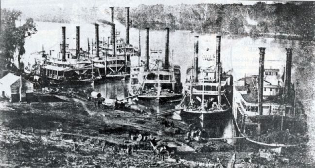
More about this marker. An engraving at center left is captioned "Steamboat transports delivered Union reinforcements to Pittsburg Landing. The Tigress (second from right) served as General Grant's floating headquarters. This engraving is based on a photograph taken shortly after the battle." (Not stated is that the Cincinnati Sanitary Commission's Tycoon, loaded with medical supplies, is at far right.) The photograph is shown below.
An engraving at center right is captioned "Union troops commanded by Major General Don Carlos Buell arrived by steamboat at Pittsburg Landing on Sunday night to support Grant's battle-weary men on the second day of fighting."
A map at right is captioned "Pittsburg Landing" but was unfortunately cut off in shooting.
A timeline of the battle is shown at the top.
Credits. This page was last revised on August 27, 2023. It was originally submitted on February 15, 2013, by David Graff of Halifax, Nova Scotia. This page has been viewed 748 times since then and 19 times this year. Last updated on August 26, 2023, by Carl Gordon Moore Jr. of North East, Maryland. Photos: 1. submitted on February 15, 2013, by David Graff of Halifax, Nova Scotia. 2. submitted on December 3, 2015, by Brandon Fletcher of Chattanooga, Tennessee. 3, 4. submitted on February 15, 2013, by David Graff of Halifax, Nova Scotia. • J. Makali Bruton was the editor who published this page.


