Monterey in Monterey County, California — The American West (Pacific Coastal)
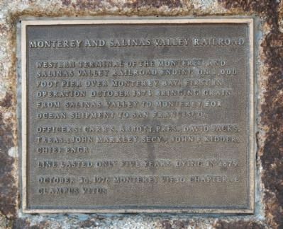
Monterey and Salinas Valley Railroad
Officers: Carr S. Abbott, Pres. ; David Jacks, Tres.; John Markeley, Secy.; John F. Kidder, Chief Engr.
Line lasted only five years, dying in 1879
Erected 1976 by E Clampus Vitus, Monterey Viejo Chapter No. 1846.
Topics and series. This historical marker is listed in this topic list: Railroads & Streetcars. In addition, it is included in the E Clampus Vitus series list. A significant historical year for this entry is 1874.
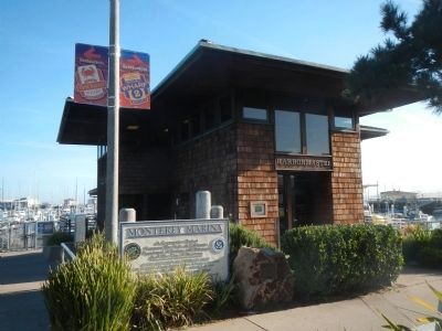
Location. 36° 36.134′ N, 121° 53.483′ W. Marker is in Monterey, California, in Monterey County. Marker can be reached from Monterey Peninsula Recreational Trail. The Monterey Peninsula Recreation Trail is a foot/bicycle path that parallels the Monterey Bay waterfront. The marker is located in front of the Harbormaster's Office between the Municipal Pier and the Old Fisherman's Pier. Touch for map. Marker is in this post office area: Monterey CA 93940, United States of America. Touch for directions.
Other nearby markers. At least 8 other markers are within walking distance of this marker. Local Railway Led the Way to America's Salad Bowl. (about 400 feet away, measured in a direct line); Monterey's Historic Railway -- from Passengers to Industry (about 400 feet away); Monterey Harbor (about 500 feet away); Monterey's Commercial Fishing Fleet (about 500 feet away); Monterey Customhouse (about 600 feet away); Custom House (about 700 feet away); a different marker also named The Custom House (about 700 feet away); a different marker also named Custom House (about 700 feet away). Touch for a list and map of all markers in Monterey.
Also see . . . The Monterey & Salinas Valley Railroad. On October 23, 1874 the first train rolled, and the Monterey & Salinas Valley Railroad become the first narrow gauge to be operated in California. By the end of the year over 6,000 tons of grain had been transported to Monterey; the combined rail and steamship rates were averaging two dollars a ton less than those charged by the Southern Pacific. (Submitted on February 15, 2013, by Barry Swackhamer of Brentwood, California.)
Credits. This page was last revised on June 16, 2016. It was originally submitted on February 15, 2013, by Barry Swackhamer of Brentwood, California. This page has been viewed 542 times since then and 15 times this year. Photos: 1, 2. submitted on February 15, 2013, by Barry Swackhamer of Brentwood, California. • Syd Whittle was the editor who published this page.

