Near Perryville in Boyle County, Kentucky — The American South (East South Central)
Lumsden's Battery
Perryville • The Battle For Kentucky
— October 8, 1862 —
Inscription.
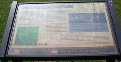
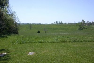
The scene must have been spectacular to the members of Captain Charles Lumsden's artillery battery. Rolling their four cannon up to this hill to support the attacking Confederate infantry, the Southern cannoneers beheld the Union line that stretched across the far ridge in front of you. Thousands of Federal soldiers were positioned on that ridge, their bayonets gleaming in the October sun.
When Lumsden's artillery was put into action against the Union position, Perryville's hilly terrain caused confusion among the Confederate gunners. While the Union line was two hills away, an optical illusion made the Federal troops appear to be on the first ridge in front of you. This deceptive terrain ruined the accuracy of Lumsden's cannon fire. Most of their shot and shell fell harmlessly into the first hill in front of you, 300 yards away from the Union position.
Later in the day, Lumsden's battery moved from this hill and was replaced by Captain Thomas Stanford's artillery. Stanford's four guns moved into position to support Donelson and Stewart's infantry, as these Confederates advanced past the Widow Gibson cabin.
We went into the fight while the enemy were firing upon us — One of their shells killing one of our horses before we got into position. The music of twelve Yankee guns and their whistling shells is not the most pleasant I have heard. For two hours, we carried on this duel, half a mile distant perhaps. I consider it almost miraculous, that (I) came out alive. - Confederate Corporal James Searcy, Lumsden's Alabama Battery
Erected by Kentucky State Parks.
Topics. This historical marker is listed in this topic list: War, US Civil.
Location. 37° 40.307′ N, 84° 58.079′ W. Marker is near Perryville, Kentucky, in Boyle County. Marker can be reached from the intersection of Park Road and Battlefield Road (Kentucky Route 1920), on the left when traveling west. This marker is Stop 13 on the Perryville Hiking Trail System. Touch for map. Marker is in this post office area: Perryville KY 40468, United States of America. Touch for directions.
Other nearby markers. At least 8 other markers are within walking distance of this marker. Donelson's Advance (about 600 feet away, measured in a direct line); The Valley of Death (about 600 feet away); Introduction (approx. 0.2 miles away); Sgt. Harris B. Cope Memorial (approx. 0.2 miles away); The Opening Attack (approx. ¼ mile away); Soldiers' Reaction to Lincoln's Emancipation (approx. ¼ mile away); Perryville and the Emancipation Proclamation (approx. ¼ mile away); Confederate Cemetery (approx. ¼ mile away). Touch for a list and map of all markers in Perryville.
More about this marker. The marker includes a battle map on the left side.
On the right is a diagram of an artillery piece captioned: Field Artillery: 12-Pounder 'Napoleon' Howitzer. The text is illegible.
Also see . . . Friends of Perryville Battlefield. This page contains a printable map of the Perryville Battlefield Hiking Trails including trail stops. (Submitted on February 16, 2013, by David Graff of Halifax, Nova Scotia.)
Credits. This page was last revised on February 25, 2021. It was originally submitted on February 16, 2013, by David Graff of Halifax, Nova Scotia. This page has been viewed 876 times since then and 39 times this year. Photos: 1, 2. submitted on February 16, 2013, by David Graff of Halifax, Nova Scotia. • Craig Swain was the editor who published this page.

