Iverness in Marin County, California — The American West (Pacific Coastal)
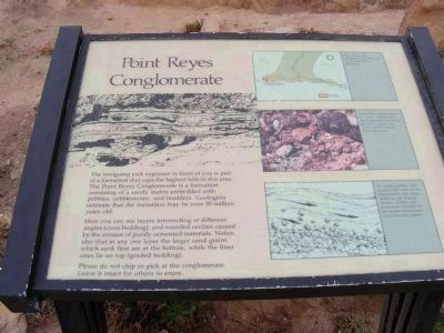
Point Reyes Conglomerate
Point Reyes National Seashore

Photographed By Don Morfe, July 5, 2009
1. Point Reyes Conglomerate Marker
Photo captions:
Upper photo:
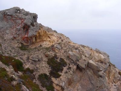
This unique rock formation is exposed on the Point Reyes peninsula.
Center photo:
Most of the colorful stones or “clasts” embedded in the conglomerate are about the size of grapes, but some measure several feet in diameter.
Lower photo:
The sands, pebbles, and boulders that make up the conglomerate were transported by fast-flowing streams, currents, and underwater landslides to the marine environment where the rock formed.
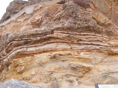
Here you can see layers intersecting at different angles (cross bedding), and rounded cavities caused by the erosion of poorly cemented materials. Notice also that in any one layer the larger sand grains which sank first are at the bottom, while the finer ones lie on top (graded bedding)
Please do not chip or pick at the conglomerate.
Leave it intact for others to enjoy.
Erected by National Park Service.
Topics. This historical marker is listed in this topic list: Environment.
Location. 37° 59.778′ N, 123° 1.2′ W. Marker is in Iverness, California, in Marin County. Marker is on Sir Francis Drake Blvd. The marker is located near the Point Reyes Lighthouse Visitor Center at the Point Reyes National Seashore. Touch for map. Marker is in this post office area: Inverness CA 94937, United States of America. Touch for directions.
Other nearby markers. At least 8 other markers are within 3 miles of this marker, measured as the crow flies. Point Reyes Light Station (here, next to this marker); Common Murres (within shouting distance of this marker); Point Reyes Light (about 300 feet away, measured in a direct line); The Rock Plants (about 600 feet away); Victims of the Coast (approx. 2.2 miles away); Lives of Sacrifice and Service are Honored Here (approx. 2.2 miles away); Whalewatching (approx. 2.3 miles away); Sea Life in These Waters (approx. 2.3 miles away).
Credits. This page was last revised on June 16, 2016. It was originally submitted on February 16, 2013, by Don Morfe of Baltimore, Maryland. This page has been viewed 521 times since then and 19 times this year. Photos: 1, 2, 3. submitted on February 16, 2013, by Don Morfe of Baltimore, Maryland. • Syd Whittle was the editor who published this page.
Editor’s want-list for this marker. Wide area view of the marker and its surroundings. • Can you help?

