Monterey in Monterey County, California — The American West (Pacific Coastal)
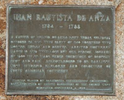
Juan Bautista de Anza
1734 – 1788
Erected 1949 by California Centennial Commission and Native Daughters of the Golden West.
Topics and series. This historical marker is listed in these topic lists: Exploration • Settlements & Settlers. In addition, it is included in the Juan Bautista de Anza National Historic Trail, and the Native Sons/Daughters of the Golden West series lists. A significant historical date for this entry is March 10, 1927.
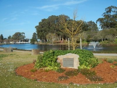
Location. 36° 35.718′ N, 121° 53.341′ W. Marker is in Monterey, California, in Monterey County. Marker is at the intersection of Fremont Street and Camino El Estero, on the right when traveling east on Fremont Street. Touch for map. Marker is at or near this postal address: 573 Fremont Street, Monterey CA 93940, United States of America. Touch for directions.
Other nearby markers. At least 8 other markers are within walking distance of this marker. Orientations At The Marsh Building (within shouting distance of this marker); Casa Buelna (about 400 feet away, measured in a direct line); Junipero Oak (about 400 feet away); De Anza Expedition (about 500 feet away); San Carlos Parish Veterans Memorial (about 500 feet away); American Revolutionary War Historical Site (about 500 feet away); Royal Presidio Chapel (about 600 feet away); Spanish Presidio (about 700 feet away). Touch for a list and map of all markers in Monterey.
Also see . . . Juan Bautista de Anza Trail Guide - Monterey County - National Park Service. The Monterey Presidio was the interim destination of Anza's settlers. They rested here in this northernmost frontier outpost of Alta California while Anza and a small party of soldiers went north on March 23 to select the sites for the San Francisco Mission and Presidio. (Submitted on February 27, 2013, by Barry Swackhamer of Brentwood, California.)
Additional commentary.
1. What Are Beeves?
"Beeves" is the plural form of the word "beef." As used on this historical marker it means cattle.
— Submitted November 21, 2018, by Alvis Hendley of San Francisco, California.
Credits. This page was last revised on January 5, 2019. It was originally submitted on February 27, 2013, by Barry Swackhamer of Brentwood, California. This page has been viewed 734 times since then and 18 times this year. Photos: 1, 2. submitted on February 27, 2013, by Barry Swackhamer of Brentwood, California. • Syd Whittle was the editor who published this page.

