Near Trask in Grant County, Indiana — The American Midwest (Great Lakes)
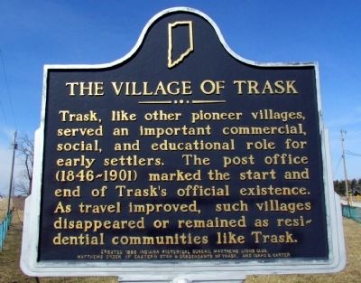
The Village of Trask
Erected 1995 by Indiana Historical Bureau, Matthews Lion Club, Matthews Order of Eastern Star & Descendants of Trask, and Isaac G. Carter. (Marker Number 27.1995.2.)
Topics and series. This historical marker is listed in this topic list: Settlements & Settlers. In addition, it is included in the Indiana Historical Bureau Markers series list.
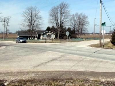
Location. 40° 25.376′ N, 85° 31.381′ W. Marker is near Trask, Indiana, in Grant County. Marker is at the intersection of State Road 26 and S. Wheeling Pike, on the left when traveling east on State Road 26. Touch for map. Marker is in this post office area: Fairmount IN 46928, United States of America. Touch for directions.
Other nearby markers. At least 8 other markers are within 4 miles of this marker, measured as the crow flies. In Memory Of William J. Leach (approx. 2.7 miles away); Lt. Col. Thomas W. (Bill) Boles (approx. 3 miles away); Matthews Veterans Memorial (approx. 3 miles away); Covered Bridge (approx. 3.1 miles away); This Covered Bridge (approx. 3.1 miles away); The New Cumberland Gristmill 1853-1920 (approx. 3.1 miles away); Cumberland Covered Bridge (approx. 3.1 miles away); Barbara Davenport (approx. 3.8 miles away).
Also see . . . IHB Review of Marker. The Indiana Historical Bureau in 2010 prepared a preliminary report on the marker regarding accuracy and relevance. Their preliminary report states "the marker text is broad, so that this marker does not just commemorate Trask, but also the hundreds of other villages and small towns across Indiana that ceased to exist". (Submitted on March 17, 2013, by Duane Hall of Abilene, Texas.)
Credits. This page was last revised on February 12, 2023. It was originally submitted on March 17, 2013, by Duane Hall of Abilene, Texas. This page has been viewed 1,096 times since then and 88 times this year. Last updated on January 29, 2023, by Craig Doda of Napoleon, Ohio. Photos: 1, 2. submitted on March 17, 2013, by Duane Hall of Abilene, Texas. • J. Makali Bruton was the editor who published this page.

