Carroll Park in Baltimore, Maryland — The American Northeast (Mid-Atlantic)
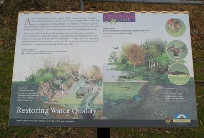
Restoring Water Quality
Gwynns Falls Trail
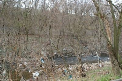
After centuries of abuse, the Gwynns Falls is being restored as a healthy stream. Government, civic groups, and scientists monitor water quality here and work together to implement restoration projects. Volunteers pick up trash, plant trees and grasses to stabilize stream banks, promote pollution reduction initiatives, and conduct environmental programs at schools and along this trail. Major storms have devastating effects on the waterway. Since the colonial era, 70 percent of the watershed's forest has disappeared and been replaced by hard, impervious surfaces such as roads and parking lots. The Gwynns Falls' tributaries have been buried in storm drains. As a result, the land cannot absorb the rainfall, and runoff scours the streambeds of the Gwynns Falls.
[illustration]
Unhealthy Stream
Rain runs off roofs, roads, and parking lots in such volume and velocity that it scours and erodes streambeds and banks.
Healthy Stream
Rain falls on trees and other vegetation and evaporates, reducing water temperatures and slowing seeping into the ground and eventually into the stream, filtered and cleaned of pollutants.
Erected by Gwynns Falls Trail Council.
Topics and series. This historical marker is listed in these topic lists: Environment • Natural Features • Waterways & Vessels. In addition, it is included in the Maryland, Gwynns Falls Trail series list.
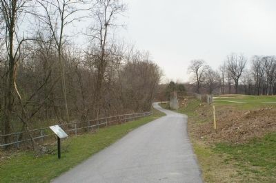
Location. This marker has been replaced by another marker nearby. It was located near 39° 16.31′ N, 76° 38.933′ W. Marker was in Baltimore, Maryland. It was in Carroll Park. Marker could be reached from Washington Boulevard. Marker is a short distance from the trailhead parking lot, in the Carroll Park Golf Course. Touch for map. Marker was in this post office area: Baltimore MD 21230, United States of America. Touch for directions.
Other nearby markers. At least 8 other markers are within walking distance of this location. Of Fords, Felles, and Falls (within shouting distance of this marker); The Baltimore Ecosystem Study (within shouting distance of this marker); Carroll Park at the Golf Course (within shouting distance of this marker); Carroll Park Golf Course (about 300 feet away, measured in a direct line); Carrollton Viaduct (approx. 0.4 miles away); Carroll Park (approx. half a mile away); Mount Clare (approx. 0.6 miles away); Camp Carroll (approx. 0.6 miles away). Touch for a list and map of all markers in Baltimore.
Related marker. Click here for another marker that is related to this marker. This marker has been replaced with the linked marker.
Credits. This page was last revised on January 15, 2024. It was originally submitted on March 19, 2008, by Christopher Busta-Peck of Shaker Heights, Ohio. This page has been viewed 1,565 times since then and 9 times this year. Photos: 1, 2, 3. submitted on March 19, 2008, by Christopher Busta-Peck of Shaker Heights, Ohio.


