Coalinga in Fresno County, California — The American West (Pacific Coastal)
The Earthquake of 1983
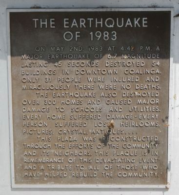
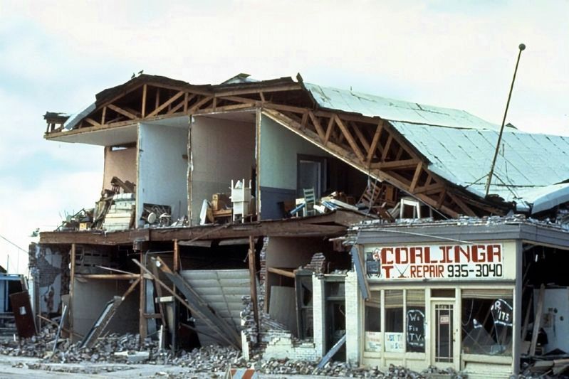
On May 2nd, 1983 at 4:42 P.M. a major earthquake of 6.7 magnitude lasting 45 seconds destroyed 54 buildings in downtown Coalinga. Only 31 people were injured and miraculously there were no deaths.
The earthquake also destroyed over 300 homes and caused major damage to schools and utilities. Every home suffered damage – every person suffered loss. Heirlooms, pictures, crystal, antiques...
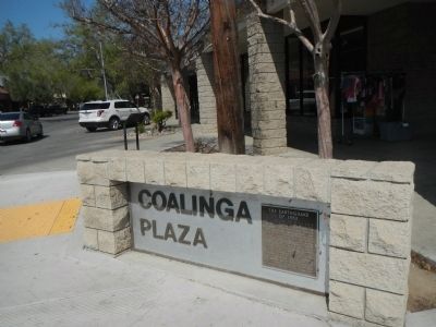
This plaza was reconstructed through the efforts of the community and its neighbors. This plaque is in remembrance of this devastating event and a tribute to all those who have helped rebuild the community.
Topics. This historical marker is listed in this topic list: Disasters. A significant historical month for this entry is May 1903.
Location. 36° 8.392′ N, 120° 21.622′ W. Marker is in Coalinga, California, in Fresno County. Marker is at the intersection of Coalinga Plaza (North 5th Street) and West Elm Street on Coalinga Plaza (North 5th Street). Touch for map. Marker is at or near this postal address: 200 Coalinga Plaza, Coalinga CA 93210, United States of America. Touch for directions.
Other nearby markers. At least 8 other markers are within walking distance of this marker. Webb Building (a few steps from this marker); Amy Building (within shouting distance of this marker); Crescent Meat Co. (within shouting distance of this marker); 5th Street, Coalinga 1912 (within shouting distance of this marker); Bordagaray’s (within shouting distance of this marker); First National Bank of Coalinga (within shouting distance of this marker); The Rockwell Building (about 300 feet away, measured in a direct line); Coalinga Opera House (about 300 feet away). Touch for a list and map of all markers in Coalinga.
Also see . . . The Coalinga Anticline and the Coalinga Earthquake of 1983. San Joaquin Valley Geology website entry:
The Coalinga earthquake was a 6.5 magnitude event on the Richter scale that struck downtown Coalinga on May 2, 1983 at 11:42 in the evening. The quake was caused when Anticline Ridge, just north and northeast of town, was pushed up and out to the south about 1 to 2 feet along a reverse fault, 10 km down, that forms the core of the fold, which is known in the oil fields as the Coalinga Anticline. (Submitted on March 25, 2013, by Barry Swackhamer of Brentwood, California.)
Credits. This page was last revised on March 24, 2023. It was originally submitted on March 25, 2013, by Barry Swackhamer of Brentwood, California. This page has been viewed 930 times since then and 71 times this year. Photos: 1. submitted on March 25, 2013, by Barry Swackhamer of Brentwood, California. 2. submitted on January 12, 2022, by Larry Gertner of New York, New York. 3. submitted on March 25, 2013, by Barry Swackhamer of Brentwood, California. • Syd Whittle was the editor who published this page.


