Gwynns Falls in Baltimore, Maryland — The American Northeast (Mid-Atlantic)
Early Industries
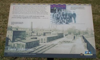
Industries have flourished here in the lower Gwynns Falls Valley since the early 1700s, when the Baltimore Iron Works Co. turned iron into nails and anchors and Dr. Charles Carroll's gristmills ground wheat into flour. The Wilkens Curled Hair Factory, which had as many as 1,000 employees, processed animal hair for use in mattresses and upholstery - and, like many other industries, dumped its waste into the waterways. Wilkens built housing for some of his workers and provided land for the avenue that bears his name today.
… in every direction a once noble landscape is in the process of being engulfed by the relentless city…
William Marye, 1921.
[photograph]
The Wilkens Curled Hair Factory, today the site of the Westside Shopping Center, remained in business from 1845 until the 1920s.
[photograph]
The Union Stockyards (left), located south of Wilkens Avenue near the railroads from 1891 to 1967, brought "every hoof under one roof" in was was claimed to be the largest stockyard east of Chicago.
Erected by Gwynns Falls Trail Council.
Topics and series. This historical marker is listed in this topic list: Industry & Commerce. In addition, it is included in the Maryland, Gwynns Falls Trail series list. A significant historical year for this entry is 1921.
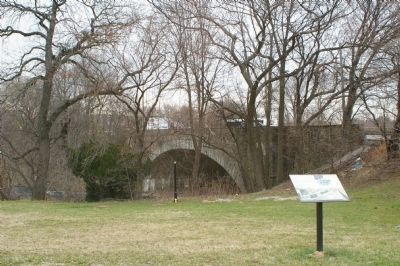
Location. 39° 16.64′ N, 76° 39.739′ W. Marker is in Baltimore, Maryland. It is in Gwynns Falls. Marker is on Hurley Avenue, 0 miles north of Wilkens Avenue (U.S. 1), on the right when traveling north. Touch for map. Marker is at or near this postal address: 540 Hurley Ave, Baltimore MD 21223, United States of America. Touch for directions.
Other nearby markers. At least 8 other markers are within walking distance of this marker. World War II Memorial (a few steps from this marker); Gwynns Falls Park at Wilkens Avenue (within shouting distance of this marker); Mt. Olivet Cemetery (approx. 0.2 miles away); Rowhouses: a Baltimore Tradition (approx. 0.3 miles away); Gwynns Falls Valley (approx. 0.3 miles away); Ellicott Flour Mills (approx. 0.3 miles away); Gwynns Falls Park at Frederick Avenue (approx. 0.4 miles away); Carrollton Viaduct (approx. 0.4 miles away). Touch for a list and map of all markers in Baltimore.
Also see . . .
1. Image of the marker. (Submitted on March 19, 2008, by Christopher Busta-Peck of Shaker Heights, Ohio.)
2. Gwynns Falls Trail Council. (Submitted on March 19, 2008, by Christopher Busta-Peck of Shaker Heights, Ohio.)
Credits. This page was last revised on February 17, 2021. It was originally submitted on March 19, 2008, by Christopher Busta-Peck of Shaker Heights, Ohio. This page has been viewed 1,902 times since then and 30 times this year. Photos: 1, 2, 3, 4. submitted on March 19, 2008, by Christopher Busta-Peck of Shaker Heights, Ohio.


