Columbia Heights in Northwest Washington in Washington, District of Columbia — The American Northeast (Mid-Atlantic)
Creating the "City Beautiful"
Meridian Hill Park, National Historic Landmark
— National Park Service, U.S. Department of the Interior —
Two principles guided both commissions. The first was Pierre L'Enfant's 1792 plan of the city, which had never been fully realized and had nearly been lost during the 19th century. The second was creation and maintenance of grand public spaces, as endorsed by the proponents of the City Beautiful movement of the 1890s, and exemplified by the Beaux Arts designs of the French and Italian Renaissance revivals. Serving as a "monumental entrance to Washington," Meridian Hill Park demonstrates both principles.
According to Meridian Hill Park's National Historic Landmark nomination (1994), "the creation of a Renaissance villa landscape in the midst of an American city to serve as a public park has no true parallel."
For more information go to: www.nps.gov/mehi
Erected by National Park Service, U.S. Department of the Interior.
Topics and series. This historical marker is listed in these topic lists: Architecture • Arts, Letters, Music • Parks & Recreational Areas. In addition, it is included in the National Historic Landmarks series list. A significant historical year for this entry is 1902.
Location. 38° 55.332′ N, 77° 2.128′ W. Marker is in Northwest Washington in Washington, District of Columbia. It is in Columbia Heights. Marker can be reached from 15th Street Northwest north of Chapin Street Northwest, on the left when traveling north. This marker is on of four on the eastern side of Meridian Hill Park along the park paths paralleling 15th Street just south of the comfort stations. They are across the street from 2407 15th St NW Washington, DC 20009. Touch for map. Marker is in this post office area: Washington DC 20009, United States of America. Touch for directions.
Other nearby markers. At least 8 other markers are within walking distance of this marker. Visionary and Park Champion (here, next to this marker); Design Challenges (here, next to this marker); Park Designers (here, next to this marker); Mansions, Parks, and People (within shouting distance of this marker); An American Meridian (within shouting distance of this marker); College Hill (about 300 feet away, measured in a direct line); Campus to Army Camps and Back Again (about 300 feet away); Art for the People (about 300 feet away). Touch for a list and map of all markers in Northwest Washington.
Photographed By Allen C. Browne, March 2, 2013
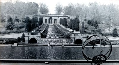
4. The Cascades
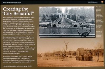
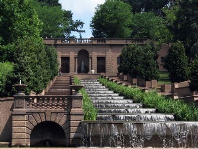
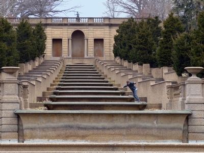
The rendering of Neo-classical and French Renaissance forms in 20th century architectural concrete make the park uniquely American. In the Cascades recirculating water flows down through thirteen basins and into the reflecting pool of the Lower Plaza.
Credits. This page was last revised on January 30, 2023. It was originally submitted on March 27, 2013, by Allen C. Browne of Silver Spring, Maryland. This page has been viewed 584 times since then and 17 times this year. Photos: 1, 2, 3, 4, 5, 6, 7, 8, 9. submitted on March 27, 2013, by Allen C. Browne of Silver Spring, Maryland. • Bill Pfingsten was the editor who published this page.
