Stilwell in Johnson County, Kansas — The American Midwest (Upper Plains)
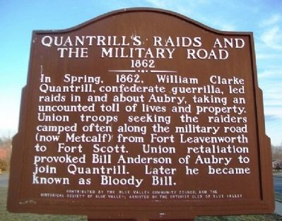
Quantrill's Raids and the Military Road
1862
Inscription.
In Spring, 1862, William Clarke Quantrill, confederate guerrilla, led raids in and about Aubry, taking an uncounted toll of lives and property. Union troops seeking the raiders camped often along the military road (now Metcalf) from Fort Leavenworth to Fort Scott. Union retaliation provoked Bill Anderson of Aubry to join Quantrill. Later he became known as Blood Bill.
Erected by Blue Valley Community Council, Historical Society of Blue Valley, and Optimist Club of Blue Valley.
Topics. This historical marker is listed in these topic lists: Forts and Castles • Roads & Vehicles • War, US Civil. A significant historical year for this entry is 1862.
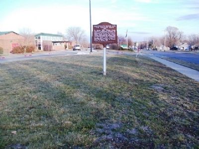
Location. 38° 46.041′ N, 94° 39.643′ W. Marker is in Stilwell, Kansas, in Johnson County. Marker is on 199th Street west of Lamar Avenue, on the right when traveling west. Marker is at Stilwell Elementary School. Touch for map. Marker is at or near this postal address: 6410 West 199th Street, Stilwell KS 66085, United States of America. Touch for directions.
Other nearby markers. At least 8 other markers are within 10 miles of this marker, measured as the crow flies. Stanley Rural High School (approx. 6.2 miles away); Santa Fe and Oregon Trails (approx. 6.2 miles away); Smoot Peace Park and Veterans Memorial (approx. 7˝ miles away in Missouri); Spring Hill Cemetery Veterans' Memorial (approx. 9˝ miles away); Rest Soldier Rest (approx. 9˝ miles away); A Most Desirable Spot For Camping (approx. 9.9 miles away); The Travelers (approx. 9.9 miles away); Roads To The West (approx. 9.9 miles away).
Also see . . .
1. William Quantrill. Wikipedia entry (Submitted on January 4, 2022, by Larry Gertner of New York, New York.)
2. Quantrill's Flag. Kansapedia website entry (Submitted on March 30, 2013, by William Fischer, Jr. of Scranton, Pennsylvania.)
Credits. This page was last revised on January 4, 2022. It was originally submitted on March 30, 2013, by William Fischer, Jr. of Scranton, Pennsylvania. This page has been viewed 999 times since then and 35 times this year. Photos: 1, 2. submitted on March 30, 2013, by William Fischer, Jr. of Scranton, Pennsylvania.

