Lee's Summit in Jackson County, Missouri — The American Midwest (Upper Plains)
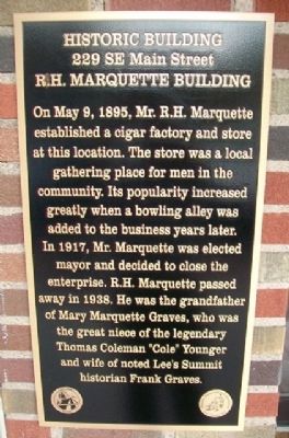
R.H. Marquette Building
229 SE Main Street
— Historic Building —
On May 9, 1895, Mr. R.H. Marquette established a cigar factory and store at this location. The store was a local gathering place for men in the community. Its popularity increased greatly when a bowling alley was added to the business years later.
In 1917, Mr. Marquette was elected mayor and decided to close the enterprise. R.H. Marquette passed away in 1938. He was the grandfather of Mary Marquette Graves, who was the great niece of the legendary Thomas Coleman "Cole" Younger and wife of noted Lee's Summit historian Frank Graves.
Erected by Lee's Summit Historic Preservation Commission.
Topics. This historical marker is listed in this topic list: Notable Buildings. A significant historical month for this entry is May 1834.
Location. 38° 54.751′ N, 94° 22.649′ W. Marker is in Lee's Summit, Missouri, in Jackson County. Marker is on SE Main Street north of SE 3rd Street, on the right when traveling north. Touch for map. Marker is at or near this postal address: 229 SE Main Street, Lees Summit MO 64063, United States of America. Touch for directions.
Other nearby markers. At least 8 other markers are within 8 miles of this marker, measured as the crow flies. All Veterans Memorial (within shouting distance of this marker); William B. Howard Station Park (within shouting distance of this marker); Harry S Truman (about 700 feet away, measured in a direct line); Flanery-Frost Cemetery (approx. 4.4 miles away); The Battle of White Oak Creek (approx. 4.8 miles away); Where Wagons Rolled / Wieduwilt Swales (approx. 7.6 miles away); Richards Flying Field (approx. 7.8 miles away); The Barnes Enclosure (approx. 8.1 miles away). Touch for a list and map of all markers in Lee's Summit.
Credits. This page was last revised on June 16, 2016. It was originally submitted on April 4, 2013, by William Fischer, Jr. of Scranton, Pennsylvania. This page has been viewed 510 times since then and 17 times this year. Photos: 1, 2. submitted on April 4, 2013, by William Fischer, Jr. of Scranton, Pennsylvania.

