Pawnee Rock in Barton County, Kansas — The American Midwest (Upper Plains)
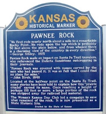
Pawnee Rock
"We first rode nearly north about a mile to a remarkable Rocky Point . . .We rode upon the top which is probably 50 feet above the plain below, and from whence there is a charming view of the country in every direction."
—George Sibley, 1825
Pawnee Rock made an impact on Santa Fe Trail travelers, who referenced the Dakota Sandstone outcropping in their journals.
"Pawnee Rock was covered with names carved by the men who had passed it. It was so full that I could find no place for mine."
— John Birch, 1848
Located at the halfway point on the Santa Fe Trail, many stories have been told to explain how this “prairie citadel” earned its name. Once reaching a height of perhaps 100 feet or more, a large portion of the rock was stripped away for railroad bed material.
The Woman's Kansas Day Club led a campaign to save what remained of the rock. It is now preserved as a State Historic Site.
Erected 2012 by the State of Kansas. (Marker Number 71.)
Topics and series. This historical marker is listed in these topic lists: Industry & Commerce • Roads & Vehicles. In addition, it is included in the Kansas Historical Society, and the Santa Fe Trail series lists. A significant historical year for this entry is 1825.
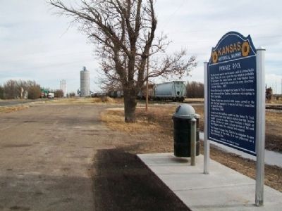
Location. 38° 15.682′ N, 98° 59.22′ W. Marker is in Pawnee Rock, Kansas, in Barton County. Marker is at the intersection of U.S. 56 and SW 70th Road / County Line Road, on the left when traveling west on U.S. 56. Marker is at a roadside pullout. Touch for map. Marker is in this post office area: Pawnee Rock KS 67567, United States of America. Touch for directions.
Other nearby markers. At least 8 other markers are within walking distance of this marker. A different marker also named Pawnee Rock (here, next to this marker); William Becknell (approx. 0.8 miles away); Santa Fe Trail (approx. 0.8 miles away); a different marker also named Santa Fe Trail (approx. 0.8 miles away); “One of the Grandest Sights Ever Beheld” (approx. 0.8 miles away); "A Rallying Point for the Indians" (approx. 0.8 miles away); Marking the Rock (approx. 0.8 miles away); Santa Fe Trail Monument (approx. 0.8 miles away). Touch for a list and map of all markers in Pawnee Rock.
More about this marker. This marker replaces an earlier state historical marker on the same subject.
Also see . . .
1. Santa Fe National Historic Trail. (Submitted on April 6, 2013, by William Fischer, Jr. of Scranton, Pennsylvania.)
2. Santa Fe Trail Association. (Submitted on April 6, 2013, by William Fischer, Jr. of Scranton, Pennsylvania.)
Credits. This page was last revised on June 16, 2016. It was originally submitted on April 6, 2013, by William Fischer, Jr. of Scranton, Pennsylvania. This page has been viewed 654 times since then and 44 times this year. Photos: 1, 2. submitted on April 6, 2013, by William Fischer, Jr. of Scranton, Pennsylvania.

