Elm Grove in Ohio County, West Virginia — The American South (Appalachia)
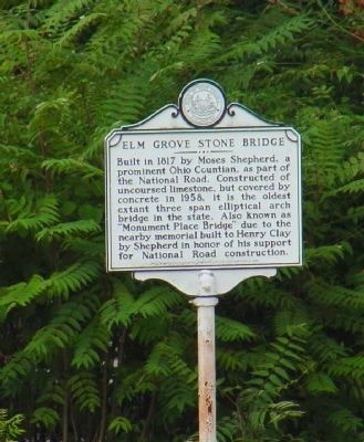
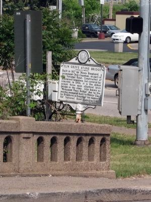
Elm Grove Stone Bridge
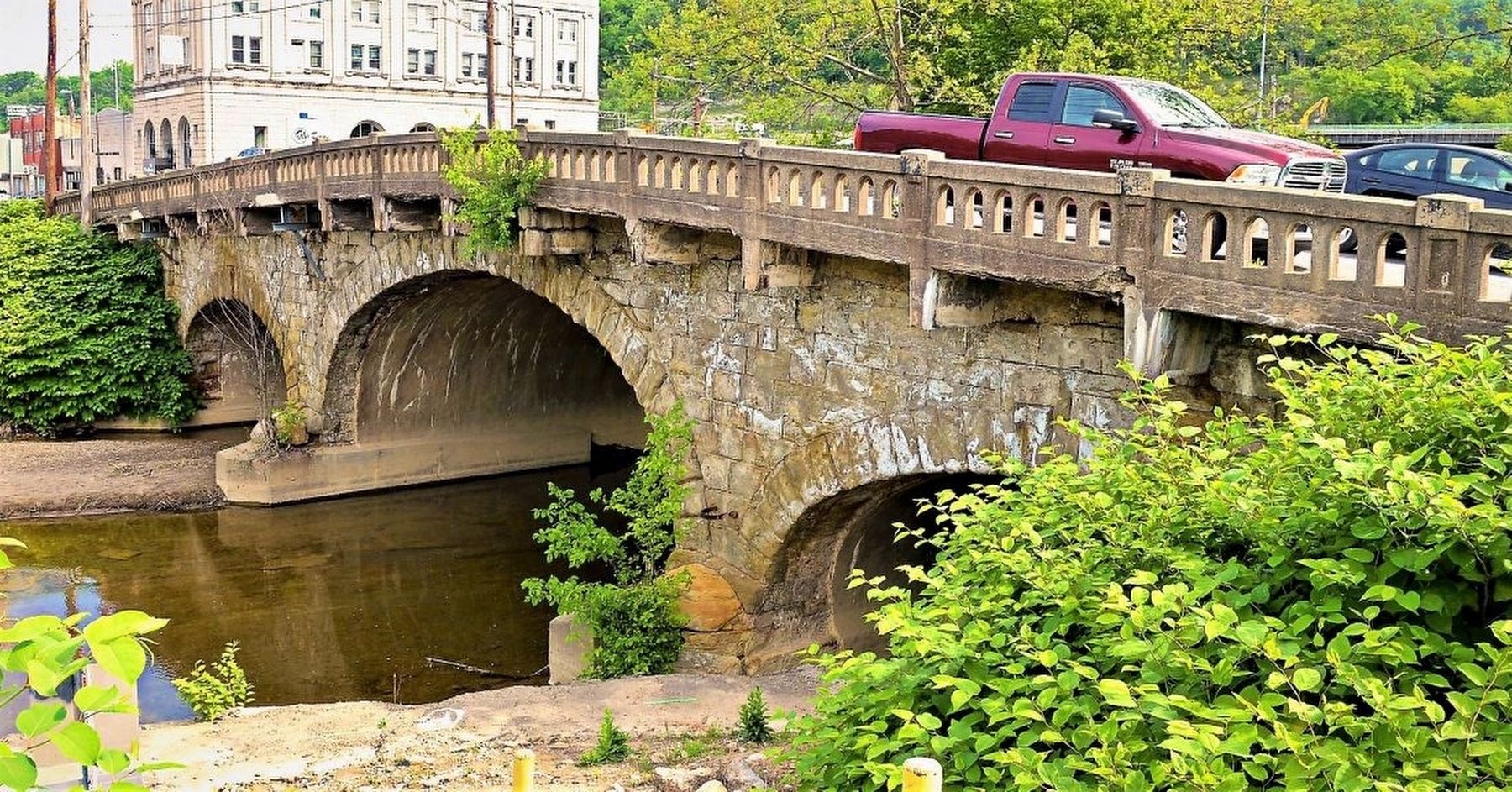
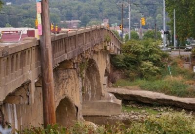
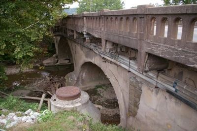
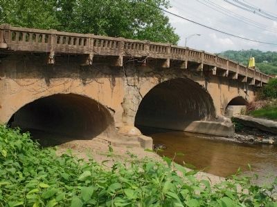
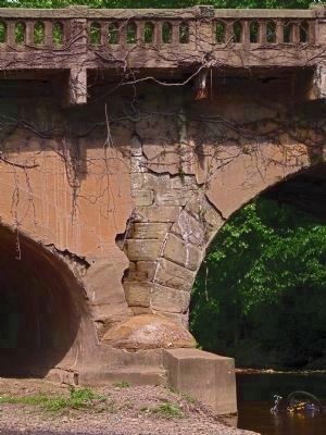
Built in 1817 by Moses Shepherd, a prominent Ohio Countian, as part of the National Road. Constructed of uncoursed limestone, but covered by concrete in 1958, it is the oldest extant three span elliptical arch bridge in the state. Also known as “Monument Place Bridge” due to the nearby memorial built to Henry Clay for Shepherd in honor of his support for National Road construction.
Erected 1982 by West Virginia Department of Archives and History.
Topics and series. This historical marker is listed in these topic lists: Bridges & Viaducts • Roads & Vehicles. In addition, it is included in the The Historic National Road, and the West Virginia Archives and History series lists. A significant historical year for this entry is 1817.
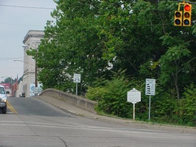
Location. 40° 2.618′ N, 80° 39.519′ W. Marker is in Elm Grove, West Virginia, in Ohio County. Marker is at the intersection of National Road (U.S. 40) and Wheeling and Elm Glove Boulevard (West Virginia Route 88), on the right when traveling west on National Road. Heading west, National Road (and U.S. 40) makes a right turn at this intersection. Route 88 continues straight ahead. The left is for Kruger Street. Touch for map. Marker is in this post office area: Wheeling WV 26003, United States of America. Touch for directions.
Other nearby markers. At least 8 other markers are within walking distance of this marker. “Monument Place” (within shouting distance of this marker); Osiris Temple Legion of Honor (within shouting distance of this marker); Forks of Wheeling Creek (about 300 feet away, measured in a direct line); a different marker also named Monument Place (about 400 feet away); War Memorial (about 600 feet away); Revolutionary War Soldiers (approx. 0.4 miles away); Grand Army of Republic (approx. 0.4 miles away); Daniel Lamb (approx. one mile away). Touch for a list and map of all markers in Elm Grove.
Regarding Elm Grove Stone Bridge. According to the National Register Nomination form, The Elm Grove bridge is the oldest extant bridge in West Virginia. "For a number of years it was thought by state and local organizations that the Van Metre Stone Arch Bridge in Berkeley County ... was West Virginia's oldest extant bridge. Information to that effect appeared in newspaper accounts over the years. There is no doubt, however that the Elm Grove Stone Arch Bridge is the state's oldest extant bridge, having been constructed in 1817 in conjunction with the National Road project. The apparent reason that the Elm Grove Bridge was overlooked for many years is that it was gunited in 1958 and, thus, camouflaged, so to speak, as a concrete bridge." -- National Register Nomination form, footnote 1.
Also see . . .
1. Elm Grove Stone Arch Bridge - National Register of Historic Places Nomination Form. West Virginia Department of Arts, Culture and History website entry (Submitted on April 9, 2013, by Allen C. Browne of Silver Spring, Maryland.)
2. Elm Grove Stone Bridge Closure Moved to 2022 - Traffic Concerns Among Main Reasons. The Intelligencer website entry (2021) (Submitted on January 30, 2022, by Larry Gertner of New York, New York.)
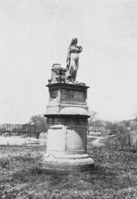
10. Henry Clay Monument
The "nearby memorial" "Erected in 1820 by Moses Shepherd and his wife Lydia to commemorate the distinguished public services of Henry Clay in behalf of the National Pike. Built of freestone and is twenty feet high. Time has effaced the inscriptions except on the east side. The Shepherd mansion built in 1798 is on a nearby eminence." -- Souvenir of Wheeling (1905).
Credits. This page was last revised on February 16, 2023. It was originally submitted on December 9, 2006, by J. J. Prats of Powell, Ohio. This page has been viewed 2,504 times since then and 44 times this year. Last updated on April 7, 2013, by Allen C. Browne of Silver Spring, Maryland. Photos: 1, 2. submitted on December 9, 2006, by J. J. Prats of Powell, Ohio. 3. submitted on January 30, 2022, by Larry Gertner of New York, New York. 4. submitted on April 7, 2013, by Allen C. Browne of Silver Spring, Maryland. 5, 6. submitted on March 19, 2008, by Christopher Busta-Peck of Shaker Heights, Ohio. 7, 8, 9. submitted on April 7, 2013, by Allen C. Browne of Silver Spring, Maryland. 10. submitted on April 9, 2013, by Allen C. Browne of Silver Spring, Maryland. • Bill Pfingsten was the editor who published this page.
