Marker Logo HMdb.org THE HISTORICAL
MARKER DATABASE
“Bite-Size Bits of Local, National, and Global History”
Weymouth in Atlantic County, New Jersey — The American Northeast (Mid-Atlantic)
 

Weymouth Furnace

Atlantic County Historical Society


Weymouth Furnace Marker image. Click for full size.
Photographed By Don Morfe, April 1, 2013
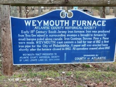
1. Weymouth Furnace Marker
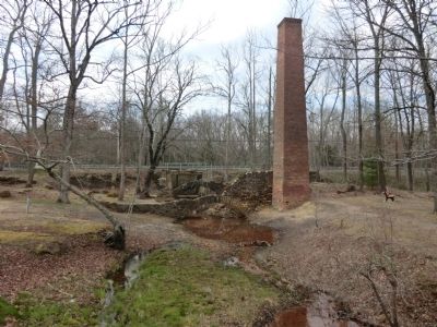
Inscription. Early 19th Century South Jersey iron furnace. Iron was produced from “Bog Ore” mined in surrounding swamps and brought to furnace by small barges poled along canals. Iron Castings, Stoves, Pots and Pans were made. Weymouth cast cannon and ball for war of 1812 and first iron pipe for the City of Philadelphia. A paper mill was erected here shortly after the furnace closed in 1862. All operations ceased about 1887.

Weymouth Tract presented to Atlantic County Historical Society by Lake Lenape Land Co. Mays Landing.
 
Erected by Sponsored by County of Atlantic.
 
Topics. This historical marker is listed in this topic list: Industry & Commerce. A significant historical year for this entry is 1812.
 
Location. 39° 31.068′ N, 74° 46.782′ W. Marker is in Weymouth, New Jersey, in Atlantic County. Marker is on Weymouth Road, 0.3 miles east of Black Horse Pike. Touch for map. Marker is in this post office area: Mays Landing NJ 08330, United States of America. Touch for directions.
 
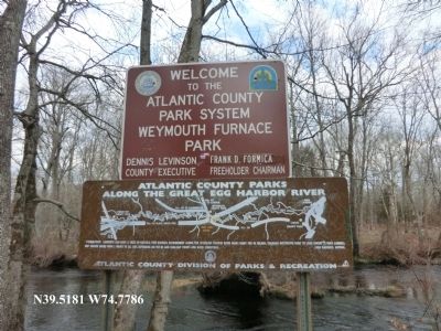
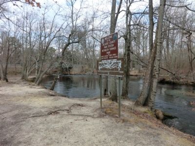
Other nearby markers. At least 8 other markers are within 6 miles of this marker, measured as the crow flies. Welcome to Atlantic County's Park at Weymouth Furnace (within shouting distance of this marker); Atlantic County Parks Along the Great Egg Harbor River (about 300 feet away, measured in a direct line); Atlantic City Expressway (approx. 3.2 miles away); World Trade Center Memorial
Paid Advertisement
Click on the ad for more information.
Please report objectionable advertising to the Editor.
Click or scan to see
this page online
(approx. 3.3 miles away); Artifact #F-0021.167 (approx. 3.3 miles away); World Trade Center (approx. 3.3 miles away); White Oak (approx. 3.3 miles away); Veterans Memorial (approx. 5.1 miles away). Touch for a list and map of all markers in Weymouth.
 
Weymouth Furnace Marker image. Click for full size.
Photographed By Don Morfe, April 1, 2013
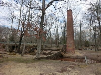
2. Weymouth Furnace Marker
Weymouth Furnace Marker image. Click for full size.
Photographed By Don Morfe, April 1, 2013
3. Weymouth Furnace Marker
Weymouth Furnace Marker image. Click for full size.
Photographed By Don Morfe, April 1, 2013
4. Weymouth Furnace Marker
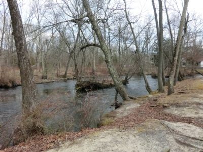
Weymouth Furnace Marker image. Click for full size.
Photographed By Don Morfe, April 1, 2013
5. Weymouth Furnace Marker
Weymouth Furnace Marker image. Click for full size.
Photographed By Don Morfe, April 1, 2013
6. Weymouth Furnace Marker
 
 
Credits. This page was last revised on June 16, 2016. It was originally submitted on April 8, 2013, by Don Morfe of Baltimore, Maryland. This page has been viewed 777 times since then and 42 times this year. Photos:   1, 2, 3, 4, 5, 6. submitted on April 8, 2013, by Don Morfe of Baltimore, Maryland. • Bill Pfingsten was the editor who published this page.
Share this page.  
Share on Tumblr
m=64262

CeraNet Cloud Computing sponsors the Historical Marker Database.
This website earns income from purchases you make after using our links to Amazon.com. We appreciate your support.
Paid Advertisement
Apr. 23, 2024