Battle Ground in Tippecanoe County, Indiana — The American Midwest (Great Lakes)
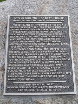
Potawatomi ‘Trail of Death’ Route
The 1811 Battle of Tippecanoe on this site was decisive, leading to the loss of their homelands and the removal of Indians from Indiana.
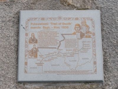
At Gunpoint, about 850 Potawatomi passed this location on September 12th, 1838 on a 660-mile trek known as the "Trail of Death" because so many, mostly children, died along the way.
After two months, about 750 Potawatomi arrived at what is now Osawatomie, Kans., joining those who had gone earlier.
A 26-year-old Potawatomi and interpreter on the Trail of Death was Nan-Wesh-Mah. After his father died, he had been adopted by a half-white older cousin, Abraham Burnett, A merchant at Fort Wayne, who had fought on the Indian side at the Battle of Tippecanoe. (Burnett's Creek nearby was named form him.) Nan-Wesh-Mah was given his adopted father's name, was sent to school, and grew up as Abram Burnett.
He farmed near Topeka, Kansas and died in 1870. Many Potawatomi were later removed from Kansas to Oklahoma.
Erected May 31, 1996 by Oklahoma Descendents of Nan-Wesh-Mah (Abram Burnett) & By Girl Scouts, Lafayette, Indiana
Erected 1996 by Oklahoma Descendents of Nan-Wesh-Mah (Abram Burnett) & By Girl Scouts, Lafayette, Indiana.
Topics and series. This historical marker is listed in these topic lists: Native Americans • Wars, US Indian. In addition, it is included in the Potawatomi Trail of Death series list. A significant historical date for this entry is May 31, 1996.
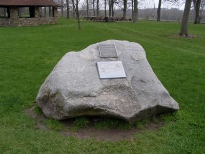
Location. 40° 30.389′ N, 86° 50.64′ W. Marker is in Battle Ground, Indiana, in Tippecanoe County. Marker is on Battleground Avenue. Located along the walk from the parking area for the Tippecanoe Battlefield memorial to the Visitor Center. Touch for map. Marker is in this post office area: Battle Ground IN 47920, United States of America. Touch for directions.
Other nearby markers. At least 8 other markers are within 4 miles of this marker, measured as the crow flies. The Battle of Tippecanoe (a few steps from this marker); The Methodist Camp (within shouting distance of this marker); Tippecanoe Battlefield Memorial (within shouting distance of this marker); Stricken Down in the Performance of Duty (within shouting distance of this marker); World War I Veterans Memorial (approx. 0.4 miles away); Prophet’s Rock (approx. 0.4 miles away); Prophet’s Town (approx. 1.1 miles away); Tecumseh Trail (approx. 3.1 miles away). Touch for a list and map of all markers in Battle Ground.
Also see . . . Potawatomi 'Trail of Death' Route. More information
regarding the route and history behind it. (Submitted on March 22, 2008, by Craig Swain of Leesburg, Virginia.)
Credits. This page was last revised on January 13, 2019. It was originally submitted on March 21, 2008, by Christopher Light of Valparaiso, Indiana. This page has been viewed 3,659 times since then and 24 times this year. Photos: 1, 2, 3. submitted on March 21, 2008, by Christopher Light of Valparaiso, Indiana. • Craig Swain was the editor who published this page.


