Fair Grove in Greene County, Missouri — The American Midwest (Upper Plains)
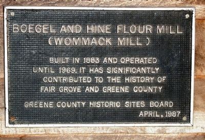
Boegel and Hine Flour Mill
Wommack Mill
Greene County Historic Sites Board April, 1987
Erected 1987 by Greene County Historic Sites Board.
Topics. This historical marker is listed in this topic list: Industry & Commerce. A significant historical month for this entry is April 1987.
Location. 37° 22.995′ N, 93° 9.067′ W. Marker is in Fair Grove, Missouri, in Greene County. Marker can be reached from S. Main, 0 miles south of Missouri Highway 125, on the left when traveling south. The plaque is on the front, external wall of the mill; located to the right of the door as you're looking at it. Touch for map. Marker is in this post office area: Fair Grove MO 65648, United States of America. Touch for directions.
Other nearby markers. At least 8 other markers are within 14 miles of this marker, measured as the crow flies. Covered Bridge, Fair Grove, Missouri (within shouting distance of this marker); Veterans Memorial (approx. 8˝ miles away); First Springfield Railroad (approx. 12.9 miles away); First Church In Greene County (approx. 13.1 miles away); Gettysburg Address (approx. 13.2 miles away); Indian Mounds (approx. 13˝ miles away); Fairbanks Hall (approx. 13˝ miles away); Tau Eta Gamma (local) (approx. 13˝ miles away).
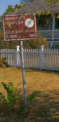
More about this marker. There is a small, secondary marker akin to a parking sign, on the right as you drive into the mill's property. It identifies the mill as a "Greene county Historical Site." It also contains the county's seal and the words: "Boegel & Hine (Wommack) Flour Mill 1883.
Regarding Boegel and Hine Flour Mill. Although there is not a separate sign, the mill is listed on the National Register of Historic Places. It is the centerpiece of Fair Grove, Missouri's, historic district.
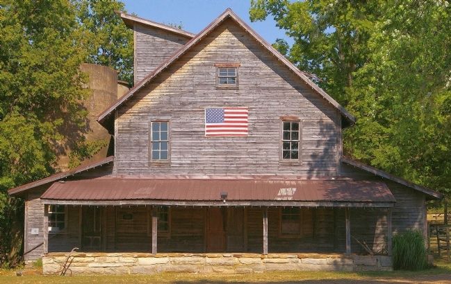
The flour mill, originally named Boegel & Hine, is unusual for a couple of reasons. 1. It stayed in operation until 1969 when, known as the Wommack Mill, it closed its doors. 2. It was steam-powered rather than water powered.
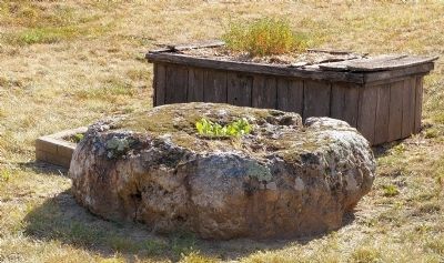
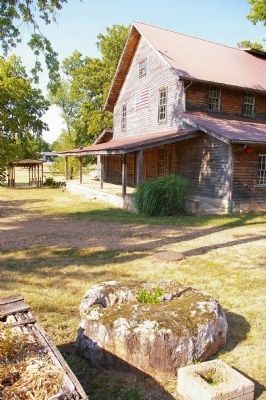
When visiting, walk around behind the mill to view the cabins on the property and the old agricultural implements in the open air. Also, be sure to note the old mill wheel used as a planter at the back of the adjacent house.
Photographed By M. Blakelylaw, July 5, 2012
3. Boegel & Hine (Wommack) Flour Mill
A grindstone from the mill can be seen at the bottom of the photo, being used as a planter on the adjacent property. The covered bridge at the top of the photo leads to an adjacent city park. It was built by the Wommacks, the mill's last operators, and is dedicated to all those in the military who died for our freedom.
Credits. This page was last revised on June 16, 2016. It was originally submitted on April 13, 2013, by M. Blakelylaw of Southeast, Oklahoma. This page has been viewed 383 times since then and 16 times this year. Photos: 1, 2. submitted on April 13, 2013, by M. Blakelylaw of Southeast, Oklahoma. 3. submitted on April 24, 2013, by M. Blakelylaw of Southeast, Oklahoma. 4, 5. submitted on April 13, 2013, by M. Blakelylaw of Southeast, Oklahoma. 6. submitted on April 24, 2013, by M. Blakelylaw of Southeast, Oklahoma. • Craig Swain was the editor who published this page.
