Rosh Ha'ayin in Petach Tikva, Central District, Israel — West Asia (the Levant in the Middle East)
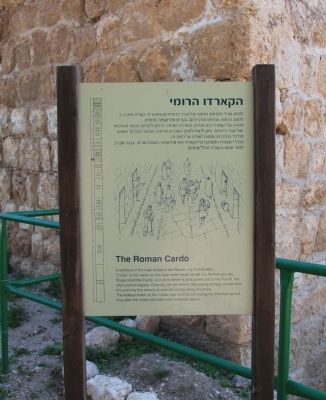
The Roman Cardo
הקארדו הרומי
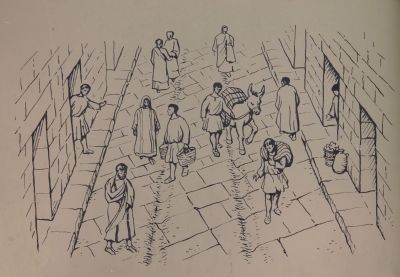
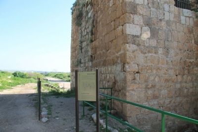
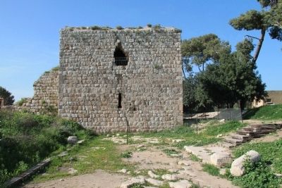
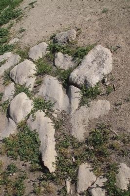
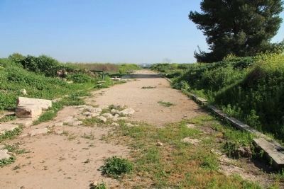
A remnant of the main street of the Roman city of Antipatris. "Cardo" is the name for the main north-south street of a Roman-era city. Shops lined the Cardo, and at its center it was connected to the Forum, the city's central square. Grooves can be seen in the paving stones, carved over the years by the wheels of vehicles rolling along the street. The lookout tower on the Cardo was constructed during the Ottoman period, long after the street had fallen into complete disuse.
Topics. This historical marker is listed in these topic lists: Anthropology & Archaeology • Roads & Vehicles • Settlements & Settlers.
Location. 32° 6.298′ N, 34° 55.837′ E. Marker is in Rosh Ha'ayin, Central District, in Petach Tikva. Marker is on Yarkon Park Entrance Roadway close to National Route 483. This historical marker is located in the interior of Yarkon Park, along a walking path that leads to the entrance of the Ottoman Fortress, just to the left (south) of the southeastern corner entrance to the fortress. Touch for map. Marker is in this post office area: Rosh Ha'ayin, Central District 48800, Israel. Touch for directions.
Other nearby markers. At least 7 other markers are within 19 kilometers of this marker, measured as the crow flies. Tel Afeq - Antipatris (within shouting distance of this marker); The Egyptian Governor's Residence (within shouting distance of this marker); The Lion Temple (approx. 17.7 kilometers away in Tel Aviv District); The Jaffa Port (approx. 17.8 kilometers away in Tel Aviv District); The Whale Sculpture (approx. 17.8 kilometers away in Tel Aviv District); The First Jewish Hostel in Jaffa (approx. 17.9 kilometers away in Tel Aviv District); The House of Simon the Tanner (approx. 17.9 kilometers away in Tel Aviv District).
Regarding The Roman Cardo. I was initially disappointed in my quest to see and experience the Roman ruins from the time of Paul, but once I could bring myself to look beyond the Ottoman fortress I was able to see other important groups of ruins. This would include the Roman ruins which are located along the Roman road that runs southeast from the southeastern fortress tower. These Roman ruins aren't nearly as numerous or significant as I had seen in visits to places like Beth Shean or Sepphoris, but I was still pleased to be walking on the very same Roman road that Paul had traveled upon.
Unfortunately, I was unable to see much more of the Roman ruins than what was in the immediate vicinity of the southeast tower of the fortress. Had I more time, I would have
liked to have walked to the end of what had been excavated of the Roman road, within the park (see the aerial photograph view of the park that is in the 5th related link).
Also see . . .
1. Yarkon Park. This is a link to information provided by Wikipedia, the free encyclopedia. (Submitted on April 12, 2013, by Dale K. Benington of Toledo, Ohio.)
2. Archaeology in Israel: Tel Afek. This is a link to related information provided by the Jewish Magazine. (Submitted on April 12, 2013, by Dale K. Benington of Toledo, Ohio.)
3. Antipatris. This is a link to information provided by Wikipedia, the free encyclopedia. (Submitted on April 12, 2013, by Dale K. Benington of Toledo, Ohio.)
4. Afek in the Sharon (Antipatris). This is a link to information provided by BibleWalks.com (Submitted on April 12, 2013, by Dale K. Benington of Toledo, Ohio.)
Credits. This page was last revised on June 5, 2023. It was originally submitted on April 12, 2013, by Dale K. Benington of Toledo, Ohio. This page has been viewed 784 times since then and 40 times this year. Last updated on April 15, 2013. Photos: 1, 2, 3, 4, 5, 6, 7. submitted on April 14, 2013, by Dale K. Benington of Toledo, Ohio. • Bill Pfingsten was the editor who published this page.
