Near Sharpsburg in Washington County, Maryland — The American Northeast (Mid-Atlantic)
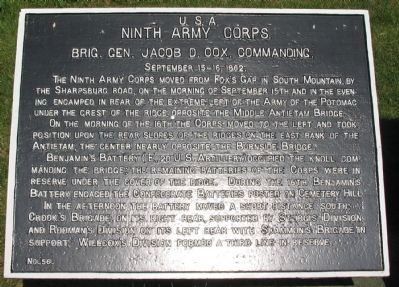
Ninth Army Corps
Ninth Army Corps
Brig. Gen. Jacob D. Cox, Commanding.
September 15-16, 1862.
The Ninth Corps moved from Fox's Gap in South Mountain by the Sharpsburg Road, on the morning of September 15 and in the evening encamped in rear of the extreme left of the Army of the Potomac under the crest of the ridge opposite the Middle Antietam Bridge.
On the morning of the 16th the Corps moved to the left and took position upon the rear slopes of the ridges on the east bank of the Antietam, the center nearly opposite the Burnside Bridge.
Benjamin's Battery (E, 2d U.S. Artillery) occupied the knoll commanding the bridge; the remaining batteries of the Corps were in reserve under the cover of the ridge. During the 16th Benjamin's Battery engaged the Confederate Batteries posted on Cemetery Hill.
In the afternoon the battery moved a short distance south; Crook's Brigade on its right rear, supported by Sturgis' Division, and Rodman's Division on its left rear with Scammon's Brigade in support. Willcox's Division formed a third line in reserve.
Erected by Antietam Battlefield Board. (Marker Number 56.)
Topics and series. This historical marker is listed in this topic list: War, US Civil. In addition, it is included in the Antietam Campaign War Department Markers series list. A significant historical month for this entry is September 1889.
Location. 39° 27.035′ N, 77° 43.88′ W. Marker is near Sharpsburg, Maryland, in Washington County. Marker can be reached from Old Burnside Bridge Road, on the left when traveling east. Located to the east of stop 9 (Burnside Bridge) of the driving tour of Antietam Battlefield, in a tablet cluster along the walking trail east of the bridge. Touch for map. Marker is in this post office area: Sharpsburg MD 21782, United States of America. Touch for directions.
Other nearby markers. At least 8 other markers are within walking distance of this marker. A different marker also named Ninth Army Corps (here, next to this marker); Fifty-First New York Infantry (here, next to this marker); Witness to History (here, next to this marker); Sturgis's Division, Ninth Army Corps (here, next to this marker); a different marker also named Ninth Army Corps (here, next to this marker); 51st Pennsylvania Volunteer Infantry (a few steps from this marker); 2nd Maryland Infantry (a few steps from this marker); "Will You Give Us Our Whiskey?" (within shouting distance of this marker). Touch for a list and map of all markers in Sharpsburg.
Related markers. Click here for a list of markers that are related to this marker. Ninth Corps in the Antietam Campaign.
Also see . . .
1. Antietam Battlefield. National Park Service site. (Submitted on March 22, 2008, by Craig Swain of Leesburg, Virginia.)
2. Ninth Army Corps. With four divisions, the IX Corps was one of the larger formations on the Federal side. Commanded by Maj. Gen. Jesse Reno at the start of the campaign. When he was killed at South Mountain, Maj. Gen. Ambrose Burnside assumed command. When assigned control of the 'Left Wing' of the Army of the Potomac (including V and IX Corps), Burnside passed the command duties to Brig. Gen. Cox. (Submitted on March 22, 2008, by Craig Swain of Leesburg, Virginia.)
3. Jacob Dolson Cox. Jacob Dolson Cox, (Jr.) (October 27, 1828 – August 4, 1900) was a lawyer, a Union Army general during the American Civil War, and later a Republican politician from Ohio. He served as the 28th Governor of Ohio and as United States Secretary of the Interior. (Submitted on September 30, 2015, by Brian Scott of Anderson, South Carolina.)
Photographed By Craig Swain, March 29, 2008
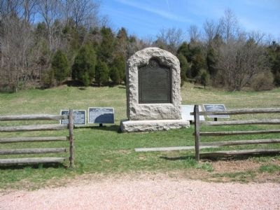
3. Monument and Tablet Cluster on East End of Burnside Bridge
From left to right are the Ninth Army Corps Tablet for September 15-16 (Number 56), Ninth Army Corps Tablet for 17 September (Number 57), The 51st New York Monument, Sturgis' Division (Number 58), and Ferrero's Brigade Tablet (Number 68)
Photographed By Matthew Brady, LOC
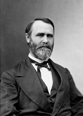
4. Jacob Dolson Cox, Jr. (1824-1900)
When corps commander Maj. Gen. Jesse L. Reno was killed at the Battle of South Mountain, Cox assumed command of the IX Corps. He suggested to Maj. Gen. Ambrose Burnside, formally the commander of IX Corps, but who was commanding a two-corps "wing" of the Army, that he be allowed to return to division command, which was more in keeping with his level of military expertise. Burnside refused the suggestion, but kept Cox under his supervision at the Battle of Antietam.
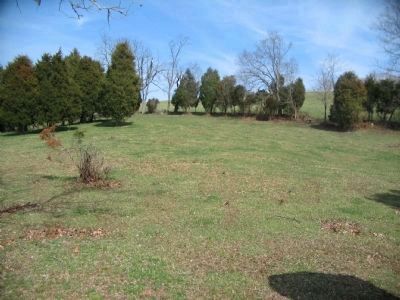
Photographed By Craig Swain, March 29, 2008
5. Artillery Positions
Prior to the battle, several IX Corps batteries were posted on this ridge line just north of the N. Rohrbach farm. The ridge is just outside of the park boundary and to the east of Burnside Bridge Road. On the morning of the battle, McMullen's and C.P. Muhlenburg's Batteries were positioned here.
Credits. This page was last revised on November 24, 2017. It was originally submitted on March 22, 2008, by Craig Swain of Leesburg, Virginia. This page has been viewed 938 times since then and 11 times this year. Photos: 1. submitted on March 22, 2008, by Craig Swain of Leesburg, Virginia. 2. submitted on September 30, 2015, by Brian Scott of Anderson, South Carolina. 3. submitted on April 1, 2008, by Craig Swain of Leesburg, Virginia. 4. submitted on September 30, 2015, by Brian Scott of Anderson, South Carolina. 5. submitted on April 1, 2008, by Craig Swain of Leesburg, Virginia.
