Three Rivers in St. Joseph County, Michigan — The American Midwest (Great Lakes)
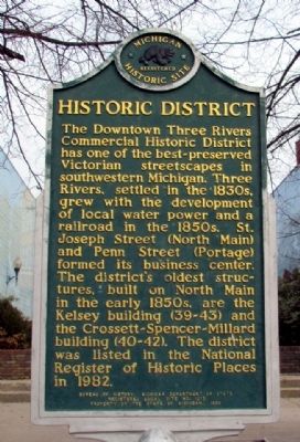
Historic District
Erected 1986 by Bureau of History, Michigan Department of State. (Marker Number L1315C.)
Topics and series. This historical marker is listed in these topic lists: Industry & Commerce • Settlements & Settlers. In addition, it is included in the Michigan Historical Commission series list. A significant historical year for this entry is 1982.
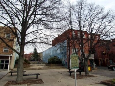
Location. 41° 56.719′ N, 85° 38.097′ W. Marker is in Three Rivers, Michigan, in St. Joseph County. Marker is on Railroad Drive, 0.1 miles north of West Michigan Street (Michigan Highway 60), on the right when traveling north. Touch for map. Marker is in this post office area: Three Rivers MI 49093, United States of America. Touch for directions.
Other nearby markers. At least 8 other markers are within walking distance of this marker. Motor Car (within shouting distance of this marker); The First National Bank of Three Rivers (within shouting distance of this marker); Old Three Rivers Public Library (about 300 feet away, measured in a direct line); Traditional Site Of Seventeenth Century Jesuit Mission (about 800 feet away); Three Rivers (approx. 0.2 miles away); The First Grist Mill in Three Rivers (approx. 0.2 miles away); The Meneely Bell (approx. 0.2 miles away); Three Rivers Town Cannon (approx. 0.2 miles away). Touch for a list and map of all markers in Three Rivers.
Credits. This page was last revised on June 16, 2016. It was originally submitted on December 10, 2012, by Duane Hall of Abilene, Texas. This page has been viewed 419 times since then and 38 times this year. Last updated on April 19, 2013, by Duane Hall of Abilene, Texas. Photos: 1, 2. submitted on December 10, 2012, by Duane Hall of Abilene, Texas. • Bernard Fisher was the editor who published this page.

