Eureka in Wayne County, North Carolina — The American South (South Atlantic)
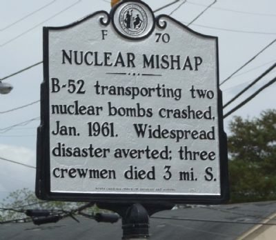
Nuclear Mishap
Erected 2012 by North Carolina Office of Archives and History. (Marker Number F-70.)
Topics and series. This historical marker is listed in these topic lists: Disasters • War, Cold. In addition, it is included in the North Carolina Division of Archives and History series list. A significant historical date for this entry is January 6, 1961.
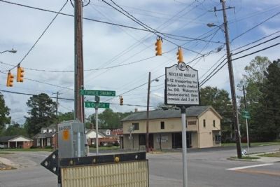
Location. 35° 32.518′ N, 77° 52.588′ W. Marker is in Eureka, North Carolina, in Wayne County. Marker is at the intersection of West Main Street (State Highway 111/222) and North Church Street (State Highway 1058), on the right when traveling west on West Main Street. Touch for map. Marker is in this post office area: Fremont NC 27830, United States of America. Touch for directions.
Other nearby markers. At least 8 other markers are within 13 miles of this marker, measured as the crow flies. Peacock's Bridge (approx. 4.7 miles away); Charles B. Aycock (approx. 6.3 miles away); James Glasgow (approx. 8.2 miles away); Nooherooka (approx. 9˝ miles away); Charles H. Darden (approx. 12.4 miles away); Plank Road (approx. 12˝ miles away); Owen L. W. Smith (approx. 12˝ miles away); Odd Fellows Home (approx. 12.6 miles away).
Regarding Nuclear Mishap. At height of the Cold War, United States policy was to keep armed aircraft in the air at all times in the event of a conflict. The number and intensity of airborne alert missions were slowed by President John F. Kennedy after several crashes including one near Goldsboro.
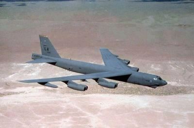
The plane that crashed in rural Wayne County, ten miles northeast of Seymour Johnson Air Force Base, just after midnight on January 24, 1961, was a B-52G Stratofortress Bomber. Internal structural damage had begun inside the right wing during refueling over South Carolina three hours earlier. After holding offshore east of Wilmington for about two hours to burn off fuel and await advice from the manufacturer, Boeing, it was attempting to land at Seymour Johnson. During preparation for landing, major structural failure of the right wing occurred immediately after which the aircraft broke up and exploded at 8,000 feet. Three members of the eight-man crew were killed.
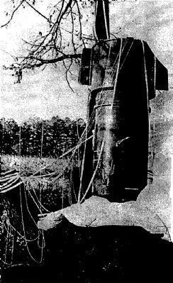
As a result of the breakup of the plane, two MK39 nuclear weapons were released at a height of between 10,000 and 2,000 feet. Seven of eight arming, fusing, and firing switches and devices in one bomb automatically actuated. Only a crew-controlled switch prevented a nuclear detonation. Since its parachute deployed, one bomb had only minor damage when it fell about a mile from the crash site. The second bomb fell free, without
its parachute deploying, and broke apart on impact.
Military personnel began to excavate the remnants of the second bomb around 1:30 A.M. Components of the bomb were sought for several weeks. The decision was made to leave remaining portions of the weapon containing uranium, believed to have entered the water table, in the ground. As a precaution, the government purchased part of the site and still maintains an easement in order to prevent digging in the vicinity. Periodic groundwater tests, still conducted by the state, have revealed no contamination.
Debate has raged among nuclear historians as to whether the two bombs were armed; the local press was told they were unarmed. The consensus is that the weapons were capable of exploding and delivering a nuclear blast sufficient to level homes in a five mile radius and cause third degree burns and set houses afire within nine miles. Many historians believe that the Goldsboro incident was one of the closest near-disasters related to the Cold War because safety interlocks on the weapons failed, having gone through all of the steps to detonate, save one.
This and similar accidents led to the development of stronger controls over detonation of nuclear weapons. A recent survey of declassified information reveals that there have been as many as forty similar nuclear weapons accidents such as the
Goldsboro “broken arrow” (a term for the accidental loss of control of a nuclear device). There is no record of any other “broken arrows” in North Carolina. (North Carolina Office of Archives & History — Department of Cultural Resources)
Also see . . .
1. The 1961 Goldsboro B-52 crash, Wikipedia entry. The two nuclear weapons separated from the gyrating aircraft as it broke up between 10,000 and 2,000 feet (Submitted on April 21, 2013, by Mike Stroud of Bluffton, South Carolina.)
2. This North Carolina sign is probably the most understated historical marker in America. (Submitted on April 21, 2013, by Mike Stroud of Bluffton, South Carolina.)
3. Report: Nuke that fell on N.C. in 1961 almost exploded. An article by Michael Winter, published in USA TODAY on September 20, 2013. (Submitted on September 21, 2013, by Kevin W. of Stafford, Virginia.)
Credits. This page was last revised on January 23, 2017. It was originally submitted on April 21, 2013, by Mike Stroud of Bluffton, South Carolina. This page has been viewed 1,546 times since then and 125 times this year. Photos: 1, 2, 3, 4. submitted on April 21, 2013, by Mike Stroud of Bluffton, South Carolina.


