Yorktown in York County, Virginia — The American South (Mid-Atlantic)
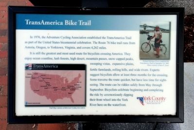
TransAmerica Bike Trail
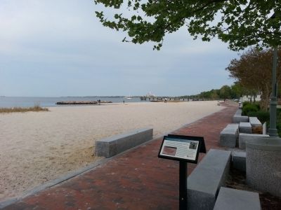
It is still the greatest and most used route for bicyclists crossing America. They enjoy ocean coastline, lush forests, high desert, mountain passes, snow capped peaks, sweeping vistas, expansive plains, fertile farmlands, rolling hills, and wide rivers. Experts suggest bicyclists allow at least three months for the crossing. Some traverse the route quicker, but have less time for sightseeing. The route can be ridden safely from May through September. Bicyclists celebrate beginning and completing the ride by ceremoniously dipping their front wheel into the York River here on the waterfront.
(captions)
Richard Nehring of Iowa completed the TransAmerica Trail on September 18, 2009. Photo courtesy of Sara E. Lewis.
Trail Map courtesy of Adventure Cycling Association.
Erected 2010 by York County.
Topics. This historical marker is listed in these topic lists: Roads & Vehicles • Sports. A significant historical year for this entry is 1976.
Location. 37° 14.19′ N, 76° 30.378′ W. Marker is in Yorktown, Virginia, in York County. Marker can be reached from Water Street west of Read Street, on the right when traveling west. Located along Yorktown's Riverwalk. Touch for map. Marker is in this post office area: Yorktown VA 23690, United States of America. Touch for directions.
Other nearby markers. At least 8 other markers are within walking distance of this marker. Yorktown's Stormy Past (here, next to this marker); Great Fire of 1814 (within shouting distance of this marker); Tobacco Inspection (within shouting distance of this marker); Yorktown Waterfront (within shouting distance of this marker); Steamboats on York River (within shouting distance of this marker); Civil War Hot-Air Balloons (within shouting distance of this marker); Yorktown’s Waterfront (about 400 feet away, measured in a direct line); Pirates in Yorktown? (about 400 feet away). Touch for a list and map of all markers in Yorktown.
Credits. This page was last revised on November 14, 2021. It was originally submitted on April 21, 2013, by Bernard Fisher of Richmond, Virginia. This page has been viewed 474 times since then and 17 times this year. Photos: 1, 2. submitted on April 21, 2013, by Bernard Fisher of Richmond, Virginia.

