Yorktown in York County, Virginia — The American South (Mid-Atlantic)
Heavy Artillery at Yorktown
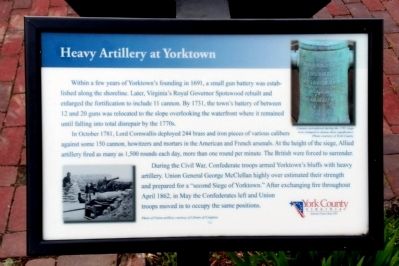
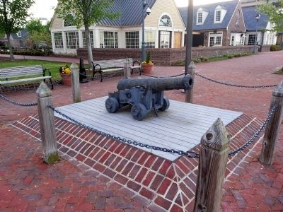
In October 1781, Lord Cornwallis deployed 244 brass and iron pieces of various calibers against some 150 cannon, howitzers and mortars in the American and French arsenals. At the height of the siege, Allied artillery fired as many as 1,500 rounds each day, more than one round per minute. The British were forced to surrender.
During the Civil War, Confederate troops armed Yorktown’s bluffs with heavy artillery. Union General George McClellan highly over estimated their strength and prepared for a “second Siege of Yorktown.” After exchanging fire throughout April 1862, in May the Confederates left and Union troops moved in to occupy the same positions.
(captions)
Cannon surrendered during the 1781 siege were stamped to denote their significance. Photo courtesy of York County.
Photo of Union artillery courtesy of Library of Congress.
Erected 2010 by York County.
Topics. This historical marker is listed in these topic lists: Colonial Era • Forts and Castles • War, US Civil • War, US Revolutionary. A significant historical year for this entry is 1691.
Location. 37° 14.331′ N, 76° 30.492′ W. Marker is in Yorktown, Virginia, in York County. Marker can be reached from Water Street west of Buckner Street, on the right when traveling west. Located along Yorktown's Riverwalk. Touch for map. Marker is in this post office area: Yorktown VA 23690, United States of America. Touch for directions.
Other nearby markers. At least 8 other markers are within walking distance of this marker. Wars & Yorktown (here, next to this marker); The Olympic Flame (within shouting distance of this marker); Kiskiak Indians (within shouting distance of this marker); Virginia Institute of Marine Science (within shouting distance of this marker); N.S. Savannah (within shouting distance of this marker); Nick's Seafood Pavilion (within shouting distance of this marker); George Washington and Francois De Grasse (within shouting distance of this marker); George P. Coleman Bridge (about 300 feet away, measured in a direct line). Touch for a list and map of all markers in Yorktown.
Credits. This page was last revised on November 14, 2021. It was originally submitted on April 21, 2013, by Bernard Fisher of Richmond, Virginia. This page has been viewed 482 times since then and 24 times this year. Photos: 1, 2, 3. submitted on April 21, 2013, by Bernard Fisher of Richmond, Virginia.


