Yorktown in York County, Virginia — The American South (Mid-Atlantic)
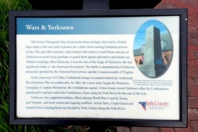
Wars & Yorktown
In the American Civil War, Confederate troops encamped behind the reinforced Revolutionary War era earthworks. In 1862, the Union army began the Peninsula Campaign to capture Richmond, the Confederate capital. Union troops seized Yorktown after the Confederates abandoned it and prevented the Confederacy from using the York River for the rest of the war.
Yorktown also supported military efforts during World Wars I and II, Korea, and Vietnam, and more recent and ongoing conflicts. Active Navy, Coast Guard and Armed Forces training bases are located in York County along the York River.
York County’s Monument on Main Street honors citizens who sacrificed their lives in military service dating back to Bacon's Rebellion. Photo courtesy of York County.
Erected 2010 by York County.
Topics. This historical marker is listed in these topic lists: War, US Civil • War, US Revolutionary. A significant historical year for this entry is 1862.
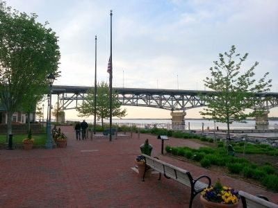
Location. 37° 14.331′ N, 76° 30.492′ W. Marker is in Yorktown, Virginia, in York County. Marker can be reached from Water Street west of Buckner Street, on the right when traveling west. Located along Yorktown's Riverwalk. Touch for map. Marker is in this post office area: Yorktown VA 23690, United States of America. Touch for directions.
Other nearby markers. At least 8 other markers are within walking distance of this marker. Heavy Artillery at Yorktown (here, next to this marker); The Olympic Flame (within shouting distance of this marker); Kiskiak Indians (within shouting distance of this marker); Virginia Institute of Marine Science (within shouting distance of this marker); N.S. Savannah (within shouting distance of this marker); Nick's Seafood Pavilion (within shouting distance of this marker); George Washington and Francois De Grasse (within shouting distance of this marker); George P. Coleman Bridge (about 300 feet away, measured in a direct line). Touch for a list and map of all markers in Yorktown.
Credits. This page was last revised on November 14, 2021. It was originally submitted on April 21, 2013, by Bernard Fisher of Richmond, Virginia. This page has been viewed 385 times since then and 16 times this year. Photos: 1, 2. submitted on April 21, 2013, by Bernard Fisher of Richmond, Virginia.

