Near Snir in Upper Galilee Regional Council, Northern District, Israel — West Asia (the Levant in the Middle East)
The Sanctuary of Pan
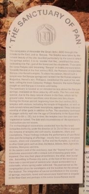
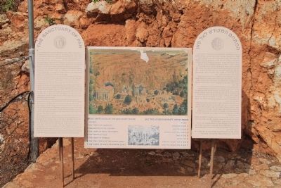
The conquests of Alexander the Great (3rd c. BCE) brought the Greeks to the East, and to Banyas. The Greeks were taken by the natural beauty of the site, touched particularly by the cave in which the springs welled. It is no wonder that they sanctified this cave, dedicating it to Pan, god of the forest and the shepherds. Thus came the name Panyas, later becoming "Banyas" in Arabic pronunciation.Towards the end of the first century BCE, the Romans incorporated Banyas into Herod's empire. To show his esteem, Herod built a temple near Banyas springs and named it for the Roman emperor Augustus. Herod's son, Philippus, established the seat of his rule here, calling the town Caesarea Philippi. However, the name Panyas caught on and Banyas it remains until today.
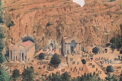
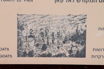
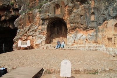
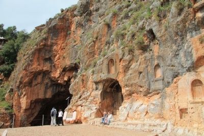
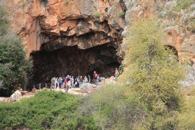
The sanctuary is located on an elevated terrace above the Banyas springs, enclosed on three sides by cliff walls. The Pan cave was special, due to the deep natural chasm in the floor, which led to ground water. Animal sacrifices were thrown into this chasm. During the Roman period, beginning from the first century BCE, temples with statues, including the temple of Augustus, as well as rock-carved niches and Greek inscriptions, appeared. These indicated worship of other gods in addition to Pan. The sanctuary continued its pagan activity well into the age of Christianity in the Byzantine era (4th to 6th c. CE), but in time, the temples near the cave were neglected or ruined. The date and circumstances of the sanctuary's destruction are not known.
The archaeological excavations conducted here by the Israel Antiquities Authority, under the direction of Dr. Zvi Uri Ma'oz, exposed the remains of temples and cult-courts, sculptures, altars and inscriptions. These findings indicate the performance of sacrificial rites and the bringing of offerings - mostly food, ceramic and glass vessels, altars and statuettes - to Pan and the Nymphs, as well as to other Greek gods such as Zeus, Asclepius, Athena, Hera, Aphrodite, Artemis, Dionysus and Aris.
At the eastern end of the sanctuary, near the "Sacred Forest", two structures associated with a unique cult of dancing goats were exposed. One was their place of exhibition; the other, their burial site. According to Panias city coins, at the foot of the sanctuary there was a sacred pool of semicircular shape surrounded by a colonnade, where spring water collected. The pool served as the congregation place for worshipers and the location for the annual Pan festival. The integration of sacred architecture in the scenery of springs, mountain, forest and natural cave found here is singular in the Near-East and perhaps in the entire Greco-Roman world.
Topics and series.
This historical marker is listed in these topic lists: Anthropology & Archaeology • Churches & Religion • Labor Unions. In addition, it is included in the Caesarea Philippi Tour series list.
Location. 33° 14.929′ N, 35° 41.67′ E. Marker is near Snir, Northern District, in Upper Galilee Regional Council. Marker can be reached from National Route 99 just east of Local Route 999, on the left when traveling north. I used google maps to try to obtain directional information, but many of the streets in this area of Israel appear to be un-named. Even in using the google map directions feature, it has the last turn being made on a street referred to as "unknown road." From Tiberias take Route 90 north about 54 km, then turn right onto Route 99 and proceed for 12.9 km, and then finally turn left onto "unknown road" for about 110 m and the Caesarea Philippi National Park will be on your right. Touch for map. Touch for directions.
Other nearby markers. At least 8 other markers are within 5 kilometers of this marker, measured as the crow flies. The Court of Pan & the Nymphs (here, next to this marker); The Grotto of the God Pan (here, next to this marker); The Temple of Zeus (here, next to this
marker); The Temple of Augustus (here, next to this marker); The Court of Nemesis (a few steps from this marker); The Tomb Temple of the Sacred Goats (within shouting distance of this marker); The Temple of Pan and The Dancing Goats (within shouting distance of this marker); The Canaanite Gate (approx. 3.7 kilometers away). Touch for a list and map of all markers in Snir.
More about this marker. This marker is located on the far side of the Hermon River Springs, near the base of a rather remarkable looking rock cliff, to the immediate right of the Grotto (cave) of Pan.
Related markers. Click here for a list of markers that are related to this marker. To better understand the relationship, study each marker in the order shown.
Also see . . .
1. Caesarea Philippi. This is a link to information provided by Wikipedia, the free encyclopedia. (Submitted on April 24, 2013, by Dale K. Benington of Toledo, Ohio.)
2. Caesarea Philippi. This is a link to information provided by the Seetheholyland.net website. (Submitted on April 24, 2013, by Dale K. Benington of Toledo, Ohio.)
3. Banias Temples. This is a link to information provided by the BibleWalks.com website. (Submitted on April 24, 2013, by Dale K. Benington of Toledo, Ohio.)
4. Caesarea Philippi, the Gates of Hades. This is a link to information provided by the Generation Word's web site. (Submitted on April 24, 2013, by Dale K. Benington of Toledo, Ohio.)
5. Banyas: Cult Center of the God Pan. This is a link to information provided by the Jewish Virtual Library. (Submitted on April 24, 2013, by Dale K. Benington of Toledo, Ohio.)
Credits. This page was last revised on December 14, 2022. It was originally submitted on April 24, 2013, by Dale K. Benington of Toledo, Ohio. This page has been viewed 2,807 times since then and 346 times this year. Photos: 1, 2, 3, 4, 5, 6, 7. submitted on April 24, 2013, by Dale K. Benington of Toledo, Ohio.
