Santa Fe in Santa Fe County, New Mexico — The American Mountains (Southwest)
La Castrense
† 1760–1859
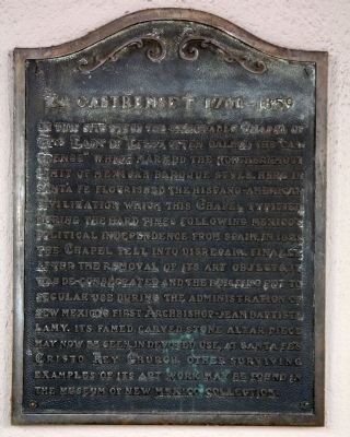
On this site stood the memorable Chapel of The Lady of Light, often called the “Castrense” which marked the northernmost limit of Mexican Baroque style. Here in Santa Fe flourished the Hispano-American civilization which this Chapel typified. During the hard times following Mexico’s political independence from Spain, in 1821, the Chapel fell into disrepair. Finally after the removal of its art objects, it was de-consecrated and the building put to secular use during the administration of New Mexico’s first Archbishop—Jean Baptiste Lamy. Its famed carved stone altar piece may now be seen, in devoted use, at Santa Fe’s Christo Rey Church. Other surviving examples of its art work may be found in the Museum of New Mexico collection.
Topics. This historical marker is listed in this topic list: Churches & Religion. A significant historical year for this entry is 1821.
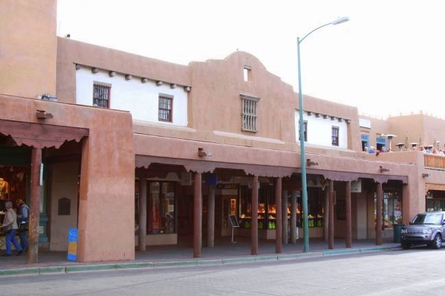
Location. 35° 41.222′ N, 105° 56.315′ W. Marker is in Santa Fe, New Mexico, in Santa Fe County. Marker is on East San Francisco Street at Santa Fe Plaza, on the right when traveling east. Touch for map. Marker is at or near this postal address: 70 East San Francisco Street, Santa Fe NM 87501, United States of America. Touch for directions.
Other nearby markers. At least 8 other markers are within walking distance of this marker. End of Santa Fe Trail (within shouting distance of this marker); U.S.S. Santa Fe CL-60 (within shouting distance of this marker); To the Heroes (within shouting distance of this marker); Santa Fe Trail (within shouting distance of this marker); Annexation of New Mexico (within shouting distance of this marker); El Palacio Real (within shouting distance of this marker); Santa Fe Plaza (about 300 feet away, measured in a direct line); Cut Stone Facade with Quoin (about 300 feet away). Touch for a list and map of all markers in Santa Fe.
Additional commentary.
1. Graves from the chapel
Hello- does anyone know where the interred were moved to?
Editor's note: Excellent question! A first glance at the church's history shows that it fell into disuse and was eventually deconsecrated and sold as private property over a period of around 20 years, meaning that it is likely that many graves were not moved. John L. Kissell's 1980 book, "The missions of New Mexico since 1776" makes the following comment:
In 1881 Delgado's widow sold to Spiegelberg Brothers next door on the east enough land to straighten the property line and put up a new store. While the foundations did brush the old east wall of the transept and lop off half the sacristy, the Daily New Mexican seemed to think that construction was going on right on top of the old church. Long-time residents remembered that the chapel had been in use as late as 1857 and that part of the lot had served as a cemetery. "Consequently," the newspaper predicted, "the excavation now in progress may bring to light some remains of departed soldiers which have not seen the light for nearly a century perhaps. Mr. Willi Spiegelberg has told Archbishop Lamy that in such case he will have such remains preserved and properly interred. As yet, however, no discoveries have been made."
— Submitted February 7, 2024, by Bill Fletcher of Santa Fe, New Mexico.
Credits. This page was last revised on February 7, 2024. It was originally submitted on April 28, 2013, by J. J. Prats of Powell, Ohio. This page has been viewed 1,022 times since then and 108 times this year. Photos: 1, 2. submitted on April 28, 2013, by J. J. Prats of Powell, Ohio.

