Sodus in Sodus Township in Berrien County, Michigan — The American Midwest (Great Lakes)
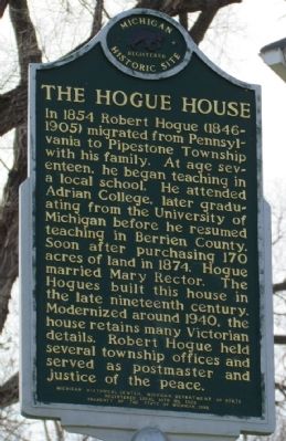
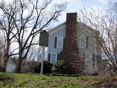
The Hogue House
Registered Michigan Historic Site
Erected 1995 by Michigan Historical Center, Michigan Department of State. (Marker Number L1923.)
Topics and series. This historical marker is listed in these topic lists: Architecture • Education • Settlements & Settlers. In addition, it is included in the Michigan Historical Commission series list. A significant historical year for this entry is 1854.
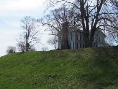
Location. 42° 3.436′ N, 86° 23.155′ W. Marker is in Sodus Township, Michigan, in Berrien County. It is in Sodus. Marker is at the intersection of Sodus Parkway and South Pipestone Road, on the right when traveling east on Sodus Parkway. Marker is located on top of a 25-foot cut bank along Sodus Parkway. Touch for map. Marker is at or near this postal address: 3361 S Pipestone Rd, Sodus MI 49126, United States of America. Touch for directions.
Other nearby markers. At least 8 other markers are within 6 miles of this marker, measured as the crow flies. The Historic District of Mary's City of David (approx. 4.2 miles away); Israelite House of David / Mary's City of David (approx. 4.2 miles away); Benton Harbor Fruit Market (approx. 4.8 miles away); The Fruit Belt (approx. 4.8 miles away); Morton Cemetery (approx. 5.1 miles away); The Morton House (approx. 5.3 miles away); Burnett's Post (approx. 5.4 miles away); Old St. Joseph Neighborhood (approx. 6.1 miles away).
Credits. This page was last revised on February 7, 2023. It was originally submitted on April 28, 2013, by Duane Hall of Abilene, Texas. This page has been viewed 884 times since then and 26 times this year. Photos: 1, 2, 3. submitted on April 28, 2013, by Duane Hall of Abilene, Texas. • Bernard Fisher was the editor who published this page.


