Near Megiddo, Haifa District, Israel — West Asia (the Levant in the Middle East)
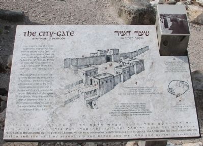
The City-Gate
(The Iron II Period)
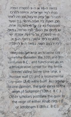
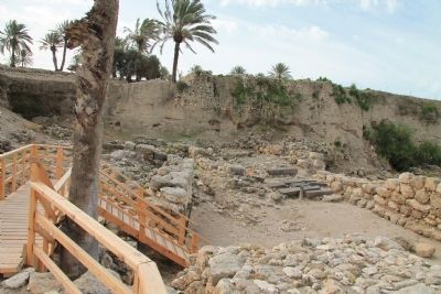
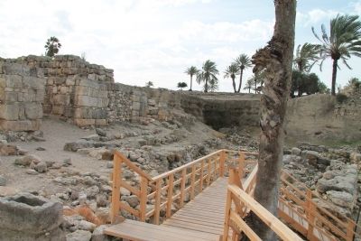
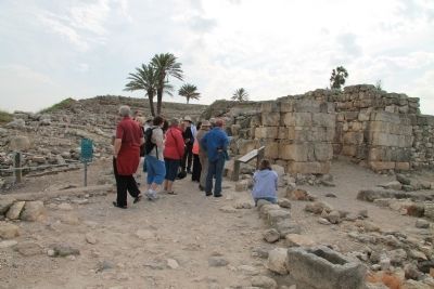
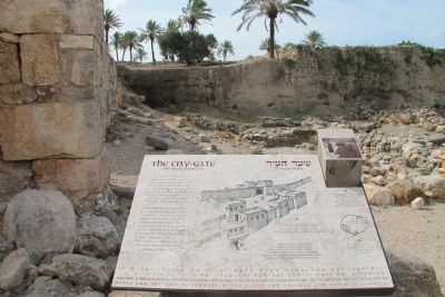
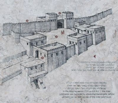
Megiddo became an Israelite city sometime between the 10th and 9th centuries B.C., and functioned as an administrative center for he fertile Jezreel Valley. Some time later, a massive wall (1) and a monumental city-gate (2-4) were built. According to one opinion, the gate dates to the reign of Solomon (10th c. B.C.). Other scholars postdate the gate to the reign of either Ahab (9th c.) or Jeroboam II (8th c. B.C.).
[Text across the Bottom of the Marker]:
"and this is the account of the forced labour which King Solomon levied to build the house of the Lord and his own house and the millo and the wall of Jerusalem and Hazor and Megiddo and Gezer." ( I Kings 9: 15)
Topics and series. This historical marker is listed in these topic lists: Anthropology & Archaeology • Forts and Castles • Settlements & Settlers. In addition, it is included in the Tel Megiddo series list.
Location. 32° 35.171′ N, 35° 11.06′ E. Marker is near Megiddo, Haifa District. Marker can be reached from National Route 66 just north of National Route 65, on the left when traveling north. This historical marker is located in the Megiddo National Park. The park is located between the Megiddo and Yokne‘am junctions (road no. 66), about 2 km west of the Megiddo junction. The historical marker is situated beyond the visitor center and parking lot, along the footpath that takes visitors to the archaeological park, and it is the second marker that you encounter at the top of Tel Megiddo (as you enter the ancient city gate). Touch for map. Touch for directions.
Other nearby markers. At least 8 other markers are within walking distance of this marker. A different marker also named The City-Gate (a few steps from this marker); The Northern Stables (within shouting distance of this marker); The Northern Palace (about 90 meters away, measured in a direct line); From Megiddo to Armageddon (about 120 meters away); Schumaker's Excavations (about 120 meters away); Tel Megiddo National Park (about 120 meters away); The Sacred Area (about 150 meters away); A Public Grain Silo (about 150 meters away). Touch for a list and map of all markers in Megiddo.
More about this marker. The "Megiddo National Park" handout/brochure has this to say about Stop 4, "The Israelite gate" (City Gate, The Iron II Period) on the historic tour:
Some time after the destruction of the Late Canaanite period (the Late Bronze Age), the city was rebuilt, preserving the Canaanite character of its inhabitants and material culture. During the period of the Israelite monarchy the city once again attained importance and was extensively built up and fortified
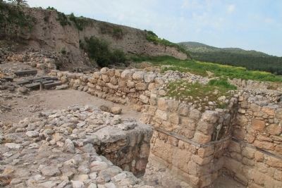
by the Israelite kings. Here you can see remains of the city gate from that time, which was incorporated into the fortifications. A two-chambered outer gate was situated at the top of the ramp that ascended to the city from the north. The inner gate you see here had six chambers and was connected to the outer gate by an L-shaped plaza. Some scholars believe this structure was merely the foundation of the inner gate. A staircase descended from the outer gate to the reservoir (1). Scholars once attributed the gate to King Solomon. However, Megiddo's present-day excavators believe it was built later, during the reign of Jeroboam II in the eighth century BCE. The western part of the inner gate was removed during the excavation. The remaining, eastern part of the gate was built of ashlars. The central chamber has not yet been excavated.
Regarding The City-Gate. The text on this historical marker shares two different views on when the Iron II period city-gates were built. These two different views are the result of the current split in scholars of Biblical archaeology and history into two camps identified as minimalists and maximalists. I have included two links to help the reader to understand what the significant issues are in these two differing views.
It should be noted that this debate in view points is focused on the period
Photographed By Dale K. Benington, March 8, 2013
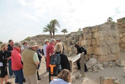
3. The City-Gate Marker
Close-up view of the illustration of the Iron II Period, city-gate, displayed on the historic marker. The listed numbered items are as follows: 1) insets-offsets wall, 2) outer gatehouse, 3) inner courtyard, 4) inner six-chambered gatehouse.
The author of one of these links (who is pro minimalist) writes, "Maximalism and Minimalism: labels for two opinions about the relation between written evidence and archaeology, which sometimes are conflicting...The labels 'maximalism' and 'minimalism' were coined in the debate about the historical reliability of the Bible. For more than a century, archaeologists have been digging in the Near East, and inevitably, they found contradictions between the archaeological record and the story told in the Bible...'Minimalism' and 'maximalism' are two principles to cope with this situation. Maximalist scholars assume that the Biblical story is more or less correct, unless archaeologists prove that it is not; minimalists assume that the Biblical story must be read as fiction, unless it can be confirmed archaeologically."
The author of the other link (who is pro maximalist) writes, "According to the minimalists, the United Monarchy never split into two kingdoms, Judah and Israel, because it never existed
in united form in the first place. Their account is that the two kingdoms developed side by side, with the Kingdom of Judah and its capital, Jerusalem, developing at a far later stage, after the consolidation of the Kingdom of Israel in the ninth and eighth centuries BCE. In this interpretation, David and Solomon are entirely fictional figures."
Related markers. Click here for a list of markers that are related to this marker. To better understand the relationship, study each marker in the order shown.
Also see . . .
1. Tel Megiddo. This is a link to information provided by Wikipedia, the free encyclopedia. (Submitted on April 29, 2013, by Dale K. Benington of Toledo, Ohio.)
2. The Megiddo Expedition. This is a link to information provided by The Megiddo Expedition Website. (Submitted on April 29, 2013, by Dale K. Benington of Toledo, Ohio.)
3. Tell Megiddo. This is a link to information provided by the BibleWalks.com website. (Submitted on April 29, 2013, by Dale K. Benington of Toledo, Ohio.)
4. Maximalists vs. Minimalists: A Good Survey. This is a link to information found in a blog sponsored by BiblePlaces.com (Submitted on May 1, 2013, by Dale K. Benington of Toledo, Ohio.)
5. 1 Kings 9: 15. This is a link to information provided by Biblos at their website entitled Bible Suite. (Submitted on April 29, 2013, by Dale K. Benington of Toledo, Ohio.)
Credits. This page was last revised on June 16, 2023. It was originally submitted on April 29, 2013, by Dale K. Benington of Toledo, Ohio. This page has been viewed 930 times since then and 48 times this year. Photos: 1, 2, 3, 4, 5, 6, 7, 8, 9. submitted on April 29, 2013, by Dale K. Benington of Toledo, Ohio.
