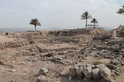
Near Megiddo, Haifa District, Israel — West Asia (the Levant in the Middle East)
Schumaker's Excavations
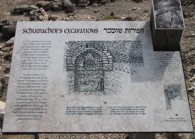
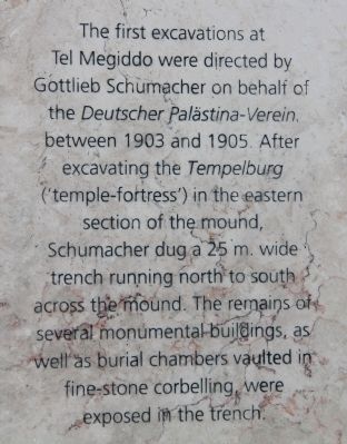
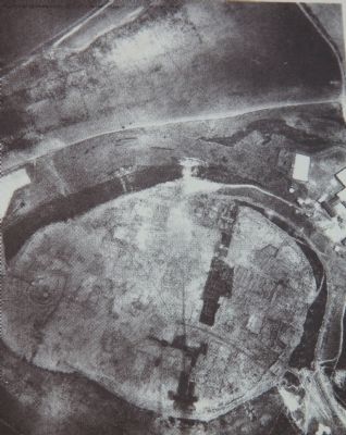
The first excavations at Tel Megiddo were directed by Gottlieb Schumacher on behalf of the Deutscher Palastina-Verein, between 1903 and 1905. After excavating the Tempelburg ('temple-fortress') in the eastern section of the mound, Schumacher dug a 25m. wide trench running north to south across the mound. The remains of several monumental buildings, as well as burial chambers vaulted in fine-stone corbelling, were exposed in the trench.
Topics and series. This historical marker is listed in these topic lists: Anthropology & Archaeology • Cemeteries & Burial Sites • Settlements & Settlers. In addition, it is included in the Tel Megiddo series list. A significant historical year for this entry is 1903.
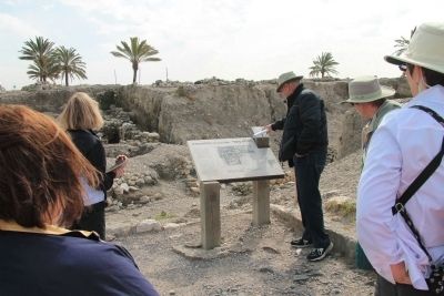
Location. 32° 35.111′ N, 35° 11.073′ E. Marker is near Megiddo, Haifa District. Marker can be reached from National Route 66 just north of National Route 65, on the left when traveling north. This historical marker is located in the Megiddo National Park. The park is located between the Megiddo and Yokne‘am junctions (road no. 66), about 2 km west of the Megiddo junction. The historical marker is situated at the top of Tel Megiddo, near the very center of the archaeological park. Touch for map. Touch for directions.
Other nearby markers. At least 8 other markers are within walking distance of this marker. A Public Grain Silo (within shouting distance of this marker); The Southern Palace (within shouting distance of this marker); The Northern Stables (about 90 meters away, measured in a direct line); The Northern Palace (about 90 meters away); The Southern Stables (about 90 meters away); The Sacred Area (about 90 meters away); A Unique Continuity (about 90 meters away); The City-Gate (about 120 meters away). Touch for a list and map of all markers in Megiddo.
More about this marker. The "Megiddo National Park" handout/brochure has this to say about Stop 10, "Burial chamber" (the 'Aegean Tomb') on the historic tour:
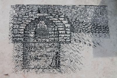
A large hole in the ground to the left of the path marks the location of the 'Aegean Tomb.' This impressive arched-roofed structure, partially built of ashlars, was preserved in its entirety. The sign presents an artist's rendering of the tomb's facade. Comparing it to similar structures throughout the Levant and Greece, the excavators deduced it was a burial structure. However, since it was found empty, both its purpose and its date are difficult to determine. It is unclear whether the structure stood out on the surface or was built underground and therefore
it is difficult to ascribe it to a particular stratum. Even today, after renewed excavation around the burial chamber, controversy persists over its dating - to either the Late Canaanite or the Israelite period I. Efforts have been made in recent years to conserve the building and prevent its collapse. A number of upright stone slabs were found near the structure; the one on the left, on a large stone base, has recently been rebuilt.
Related markers. Click here for a list of markers that are related to this marker. To better understand the relationship, study each marker in the order shown.
Also see . . .
1. Tel Megiddo. This is a link to information provided by Wikipedia, the free encyclopedia. (Submitted on May 3, 2013, by Dale K. Benington of Toledo, Ohio.)
2. The Megiddo Expedition. This is a link to information provided by The Megiddo Expedition Website. (Submitted on May 3, 2013, by Dale K. Benington of Toledo, Ohio.)
3. Tell Megiddo. This is a link to information provided by the BibleWalks.com website. (Submitted on May 3, 2013, by Dale K. Benington of Toledo, Ohio.)
Photographed By Dale K. Benington, March 8, 2013
3. Schumaker's Excavations Marker
Close-up view of the illustration of part of Schumaker's Excavation displayed on the historic marker. The caption for the illustration reads as follows: "This corbelled tomb, apparently dating to the Late Bronze II (ca. 1400-1150 B.C.), is unique in Israel. Its exceptional size and workmanship suggest that it was built for a member of Megiddo's royal family."
Credits. This page was last revised on December 20, 2023. It was originally submitted on May 3, 2013, by Dale K. Benington of Toledo, Ohio. This page has been viewed 701 times since then and 30 times this year. Photos: 1. submitted on May 3, 2013, by Dale K. Benington of Toledo, Ohio. 2, 3, 4, 5, 6. submitted on May 4, 2013, by Dale K. Benington of Toledo, Ohio.
