Near Sharpsburg in Washington County, Maryland — The American Northeast (Mid-Atlantic)
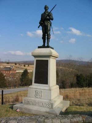
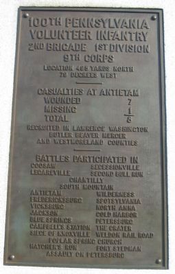
100th Pennsylvania Volunteer Infantry
9th Corps
Location 495 yards north
79 degrees west
——————
Casualties at Antietam
Wounded 7
Missing 1
Total 8
Recruited in Lawrence Washington
Butler Beaver Mercer
and Westmoreland Counties
—————
Battles Participated in
Coosaw - Secessionville
Legareville - Second Bull Run
Chantilly
South Mountain
Antietam - Wilderness
Fredericksburg - Spotsylvania
Vicksburg - North Anna
Jackson - Cold Harbor
Blue Springs - Petersburg
Campbell's Station - The Crater
Siege of Knoxville - Weldon Rail Road
Poplar Spring Church
Hatcher's Run - Fort Stedman
Assault on Petersburg
Roundheads
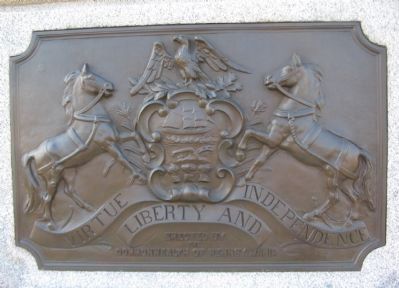
Erected 1904 by Commonwealth of Pennsylvania.
Topics. This historical marker is listed in this topic list: War, US Civil.
Location. 39° 27.283′ N, 77° 44.32′ W. Marker is near Sharpsburg, Maryland, in Washington County. Marker is at the intersection of Branch Avenue and Old Burnside Bridge Road, on the left when traveling south on Branch Avenue. Located at stop 10, the Final Attack, of the driving tour of Antietam Battlefield. Touch for map. Marker is in this post office area: Sharpsburg MD 21782, United States of America. Touch for directions.
Other nearby markers. At least 8 other markers are within walking distance of this marker. 45th Pennsylvania Volunteer Infantry (a few steps from this marker); 36th Ohio Volunteer Infantry (about 300 feet away, measured in a direct line); “Forever Free” (about 500 feet away); Ninth Army Corps (about 500 feet away); Willcox's Division, Ninth Army Corps (about 500 feet away); The Advance Was Made With the Utmost Enthusiasm (about 500 feet away); Brown’s (Wise), Virginia Battery (about 500 feet away); The Fate of the Army (about 500 feet away). Touch for a list and map of all markers in Sharpsburg.
Also see . . .
1. 100th Pennsylvania Volunteer Infantry Monument
. National Park Service site detailing the monument. (Submitted on March 23, 2008, by Craig Swain of Leesburg, Virginia.)
2. 100th Regt, Pennsylvania Veteran Volunteer Infantry, "The Roundheads". Website homepage (Submitted on July 18, 2023, by Larry Gertner of New York, New York.)
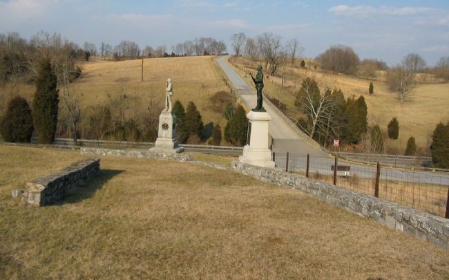
Photographed By Craig Swain
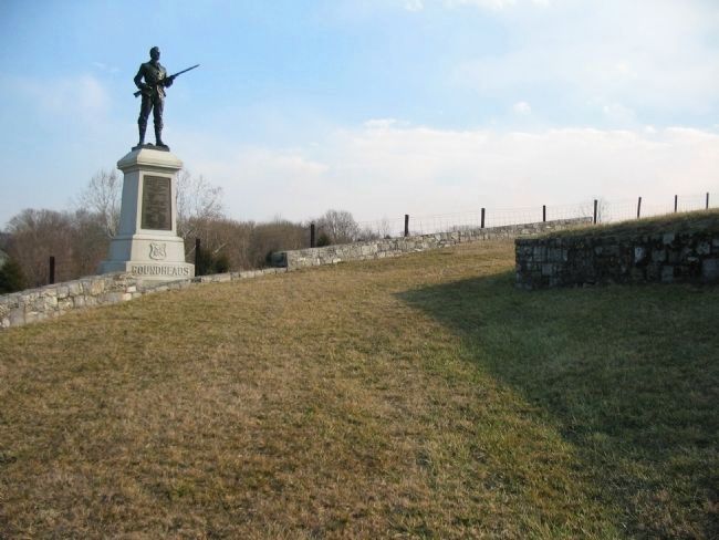
4. Two Pennsylvania Monuments
The 45th and 100th Pennsylvania Monuments stand on the ground held by Welsh's Brigade during the afternoon phases of the battle. The 45th advanced through the ravine beyond the monuments were the modern Burnside Bridge Road passes. The 100th advanced across the foreground here. Between the Pennsylvanians was the 46th New York Infantry. On the high ground to the north, along Rodman Avenue, the 79th New York of Christ's Brigade advanced along side the Pennsylvanians.
Credits. This page was last revised on July 18, 2023. It was originally submitted on March 23, 2008, by Craig Swain of Leesburg, Virginia. This page has been viewed 1,442 times since then and 24 times this year. Photos: 1, 2, 3, 4, 5. submitted on March 23, 2008, by Craig Swain of Leesburg, Virginia. 6. submitted on March 4, 2021, by Bradley Owen of Morgantown, West Virginia.
