Pennsville in Salem County, New Jersey — The American Northeast (Mid-Atlantic)
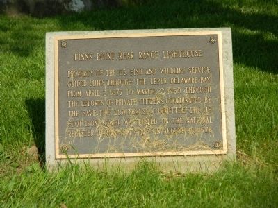
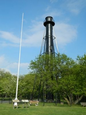
Finns Point Rear Range Lighthouse
Erected 1978.
Topics and series. This historical marker is listed in these topic lists: Landmarks • Waterways & Vessels. In addition, it is included in the Lighthouses series list. A significant historical month for this entry is March 2007.
Location. 39° 37.017′ N, 75° 32.033′ W. Marker is in Pennsville, New Jersey, in Salem County. Marker is at the intersection of Old Fort Mott Road and Harrisonville Lighthouse Road on Old Fort Mott Road. Touch for map. Marker is in this post office area: Pennsville NJ 08070, United States of America. Touch for directions.
Other nearby markers. At least 8 other markers are within 2 miles of this marker, measured as the crow flies. Finns Point Rear Range Light (here, next to this marker); Supawna Meadows National Wildlife Refuge (within shouting distance of this marker); Address by President Lincoln (approx. 1.2 miles away); Finn’s Point National Cemetery (approx. 1.2 miles away); a different marker also named Finn’s Point National Cemetery (approx. 1.2 miles away); Confederate Monument (approx. 1.2 miles away); Observation Towers (approx. 1.2 miles away); Union Monument (approx. 1.2 miles away). Touch for a list and map of all markers in Pennsville.

Photographed By Nate Davidson, May 9, 2013
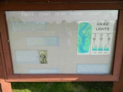
2. Finns Point Rear Range Light
Built in 1876, at a cost of $1,200, this light (together with the Finn's Point Front Range Light) was operated by the U.S. Lighthouse Establishment from April 2, 1877 until March 22, 1950. It was later taken over by the U.S. Coast Guard. This kerosene-vapor light used a catadioptric lens and produced a 150,000 candle power, fixed, non-flashing, beacon. The tower stands 115 ft. high with a focal point 105 ft. above mean low water.
In 1934, the light was made automatic. Prior to this, the lightkeeper had to climb the 130 steps each night to light the lamp and then climb up again in the morning to extinguish it. The keepers lived in a government house (originally located directly behind you) and received a $500 annual salary. Inspectors came every 3 months, but other visitors were rare. Despite the isolation and loneliness, there were some people who liked the job and actively sought it.
On March 22, 1950, the light was permanently turned off (due to changes in the river channel) and on June 18, 1951 the U.S. Coast Guard declared the lighthouse "excess property." In the late 1950s, the lighthouse was turned over to the U.S. Fish and Wildlife Service as part of the Killcohook Coordination Area. Currently, this property is part of Supawna Meadows NWR. On August 30, 1978, this lighthouse was added to the National Register of Historic Places. During 1983 the U.S.F.W.S. hired contractors to clean, sandblast, repair, and repaint the lighthouse at a cost of $33,199.
The front light, no longer in existance, was located 1 5/8 miles south of the rear light, on the bank of the Delaware River. This light was located on a white wooden tower, having a focal point 30 ft. above mean low water.
Range lights are commonly used on the Delaware River to indicate the shipping channel. Each range consists of a pair of lights, front and rear, which, when viewed from the channel, appear to be lined up. This particular rear-range light had a red "sector", i.e. a section of the lens that was only visible from a certain location on the river, usually as a warning of shoals. In this particular case, the red sector indicated the proper place to turn from this range, or section of the channel, into the "New Castle Range."
Credits. This page was last revised on June 16, 2016. It was originally submitted on May 11, 2013, by Nathan Davidson of Salisbury, Maryland. This page has been viewed 506 times since then and 7 times this year. Photos: 1, 2, 3. submitted on May 11, 2013, by Nathan Davidson of Salisbury, Maryland. • Bill Pfingsten was the editor who published this page.

