Bunyan in Beaufort County, North Carolina — The American South (South Atlantic)
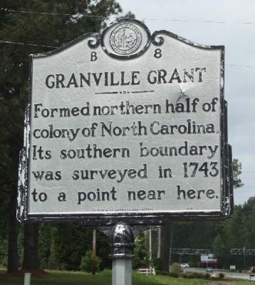
Granville Grant
Erected 1993 by Division of Archives and History. (Marker Number B-8.)
Topics and series. This historical marker is listed in these topic lists: Colonial Era • Political Subdivisions • Settlements & Settlers. In addition, it is included in the North Carolina Division of Archives and History series list. A significant historical year for this entry is 1743.
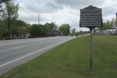
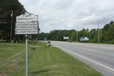
Location. 35° 32.11′ N, 76° 58.38′ W. Marker is in Bunyan, North Carolina, in Beaufort County. Marker is on John Small Avenue (U.S. 264) near Eborn Lane, on the right when traveling east. Touch for map. Marker is in this post office area: Washington NC 27889, United States of America. Touch for directions.
Other nearby markers. At least 8 other markers are within 5 miles of this marker, measured as the crow flies. Garden of Honor and Devotion (approx. 3.2 miles away); Jack's Creek (approx. 4 miles away); Battlefield Cross (approx. 4.2 miles away); Memorial (approx. 4.2 miles away); Veterans Memorial Park (approx. 4.3 miles away); Beaufort County World War I Memorial (approx. 4.3 miles away); Oakdale Cemetery (approx. 4.3 miles away); Josephus Daniels (approx. 4.4 miles away).
Regarding Granville Grant. On March 24, 1663, King Charles II granted eight men, the Lord Proprietors, the charter for a tract of land called Carolina in the American colonies. The charter was renewed in 1665. By 1729, seven of the eight Proprietors (or their heirs) had sold their interests back to the English government. The eighth Proprietor, John Lord Carteret, inherited from his grandfather the title of Earl Granville and one-eighth of the Carolina territory, which ranged from modern-day Virginia to Florida and from the Atlantic to the Pacific. Granville refused to sell his territory back to King George II, and his one-eighth of Carolina became the Granville District.
John Carteret retained his interests and, from 1729 until 1742, representatives of Earl Granville and the Crown met sporadically to address Granville’s claim. In September 1742, King George II and the Privy Council officially approved the Granville grant. Although Granville’s claim was to one-eighth of Carolina as a whole, it was decreed that it be measured from the southern border of Virginia. Therefore, the Granville Grant included lands within sixty-five miles of the southern Virginia border, comprising the northern half of present-day North Carolina.
Following the establishment of the Granville District, survey of the grant began in 1742 at Cape Hatteras. The assessors took several years to complete the project,
continuing only as far as Bath in its early years. The southern boundary of the tract may be traced across modern-day North Carolina: from Engelhard in Hyde County, to a point in Beaufort County near Bunyan, to the Haw River near Moncure, to points along the Cabarrus/Rowan county line and the Iredell/Mecklenburg county line.
Lord Granville relinquished his control in government in 1742, but retained the power to grant land which was done through local agents, including Francis Corbin and Thomas Child. Between 1748, when the granting office was established, and 1763, when John Carteret died, the agents granted land, collected rents, and surveyed for settlers. The largest tract of land granted in the Granville district was to a Moravian colony led by Bishop August Spangenberg, and included 98,985 acres, later called Wachovia.
The Granville district had many problems throughout it history, stemming from the corruption of Granville’s local officials, and culminated with the Enfield Riot of 1759. After John Carteret’s death in 1763, the granting office closed under Carteret’s heir, Robert Earl Granville. The office’s problems soon became irrelevant with the outbreak of the Revolutionary War when the district was dissolved by the North Carolina state government. In the early 1800s the heirs of Earl Granville attempted to sue for reinstitution of their land,
but the suit was rejected and the appeal dropped in 1817.(North Carolina Office of Archives & History — Department of Cultural Resources)
Credits. This page was last revised on June 22, 2021. It was originally submitted on May 12, 2013, by Mike Stroud of Bluffton, South Carolina. This page has been viewed 1,009 times since then and 93 times this year. Photos: 1, 2, 3. submitted on May 12, 2013, by Mike Stroud of Bluffton, South Carolina.


