Dodge City in Ford County, Kansas — The American Midwest (Upper Plains)
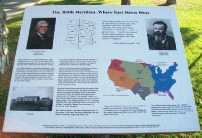
The 100th Meridian, Where East Meets West
Inscription.
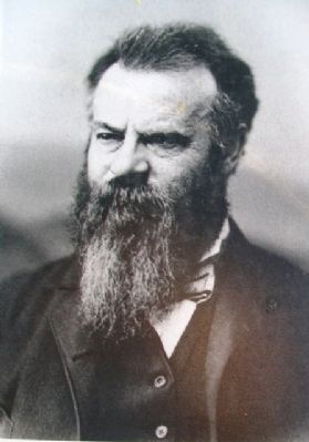
"Experience teaches that it is not wise to depend upon rainfall where the amount is less than 20 inches annually. The isohyetal or mean rainfall line of 20 inches…in a general way…may be represented by the 100th meridian. [In this region] agriculturalists will early resort to irrigation."
- John Wesley Powell, 1879
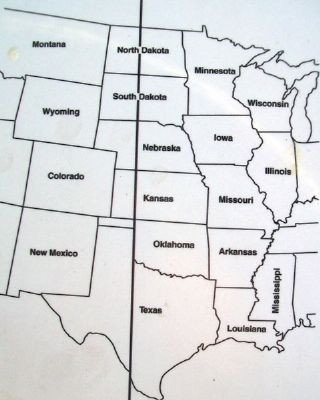
Dodge City lies on the 100th Meridian, the 100th longitudinal line west of Greenwich, England. The meridian passes through the city approximately one mile east of this marker between Avenues L and M.
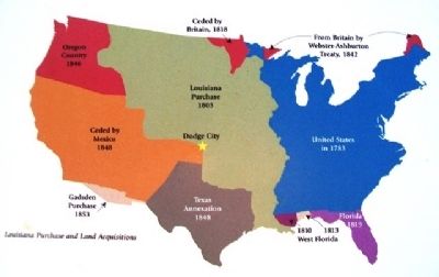
The 100th Meridian is historically significant to this region. Much of the land west of the Mississippi River to the Rocky Mountains region was once claimed by France. In 1803 President Thomas Jefferson acquired this territory in what became known as the Louisiana Purchase. The approximately 827,000 square mile territory was purchased for $15 million and doubled the size of the country.
The land on which Dodge City sets was included in the Louisiana Territory. However the western and southern boundaries of the purchase were poorly defined due to competing claims by Spain.
In 1819, the border between the Louisiana Territory and the Spanish claims was defined by the Adams-Onis Treaty. In this treaty, the intersection of the 100th Meridian with the Arkansas River (located approximately one half mile south) was fixed as one corner. The land on which you stand remained part of the Louisiana Territory under the jurisdiction of the United States. The land to the west and south of the river remained for a time under the control of Spain's Mexican colony.
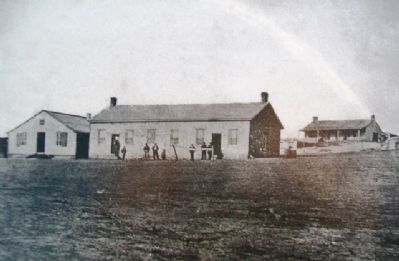
After the United States acquired the area south of the Arkansas River from Mexico, the 100th Meridian was used as the western boundary of the Osage Indian Reservation. When the United States government established Fort Dodge for its strategic location on the Santa Fe Trail, the site selected was to the east and within miles of the 100th meridian. In 1872, the town of Dodge City was established on the west edge of the military reservation, leaving the present day city astride the 100th Meridian.
The 100th Meridian, although an imaginary line on the surface of the earth, has long symbolized the end of the east and the beginning of the west.
Major John Wesley Powell, an early western explorer and the second director of the United States Geological Survey, recognized the 100th Meridian as the natural demarcation line between the humid east and the arid west.
The 100th Meridian approximates the 2,000 foot elevation line above sea level. Weather systems divert moisture from the Gulf of Mexico easterly from this point. To the west the climate becomes more arid and the land
slopes gently upwards to the Rocky Mountains.
Text resource: Geography at About - http://geography.about.com. Photo credits: John Wesley Powell courtesy Utah State Historical Society; Fort Dodge, courtesy Kansas Heritage Center; Thomas Jefferson, painting by Rembrandt Peale, White House Collection; Map of Louisiana Purchase and land acquisitions, designed by Cynthia Vierthaler, Spearville News, Inc.
Topics and series. This historical marker is listed in these topic lists: Communications • Exploration. In addition, it is included in the Former U.S. Presidents: #03 Thomas Jefferson series list. A significant historical year for this entry is 1879.
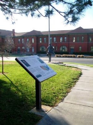
Location. 37° 45.177′ N, 100° 1.012′ W. Marker is in Dodge City, Kansas, in Ford County. Marker is at the intersection of Central Avenue and Front Street, on the right when traveling north on Central Avenue. Touch for map. Marker is in this post office area: Dodge City KS 67801, United States of America. Touch for directions.
Other nearby markers. At least 8 other markers are within walking distance of this marker. Wyatt Earp (a few steps from this marker); Dodge City, a railroad town (a few steps from this marker); "Doc" Holliday (a few steps from this marker); "Big Nose Kate" (about 300 feet away, measured in a direct line); Charles Rath (about 600 feet away); Wild and woolly Front Street (about 700 feet away); Dodge City, full of excitement (about 700 feet away); Longhorn cattle arrive (about 700 feet away). Touch for a list and map of all markers in Dodge City.
Also see . . .
1. 100th Meridian Counties. Twelve Mile Circle website entry (Submitted on May 13, 2013, by William Fischer, Jr. of Scranton, Pennsylvania.)
2. 100th meridian west. Wikipedia entry (Submitted on May 13, 2013, by William Fischer, Jr. of Scranton, Pennsylvania.)
3. Dodge City Convention & Visitor’s Bureau. Website homepage (Submitted on December 27, 2021, by Larry Gertner of New York, New York.)
Credits. This page was last revised on March 6, 2024. It was originally submitted on May 12, 2013, by William Fischer, Jr. of Scranton, Pennsylvania. This page has been viewed 1,528 times since then and 99 times this year. Photos: 1, 2, 3, 4, 5, 6. submitted on May 13, 2013, by William Fischer, Jr. of Scranton, Pennsylvania.
