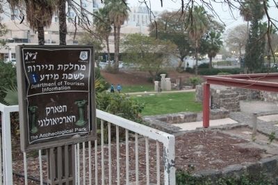
Tiberias, Northern District, Israel — West Asia (the Levant in the Middle East)
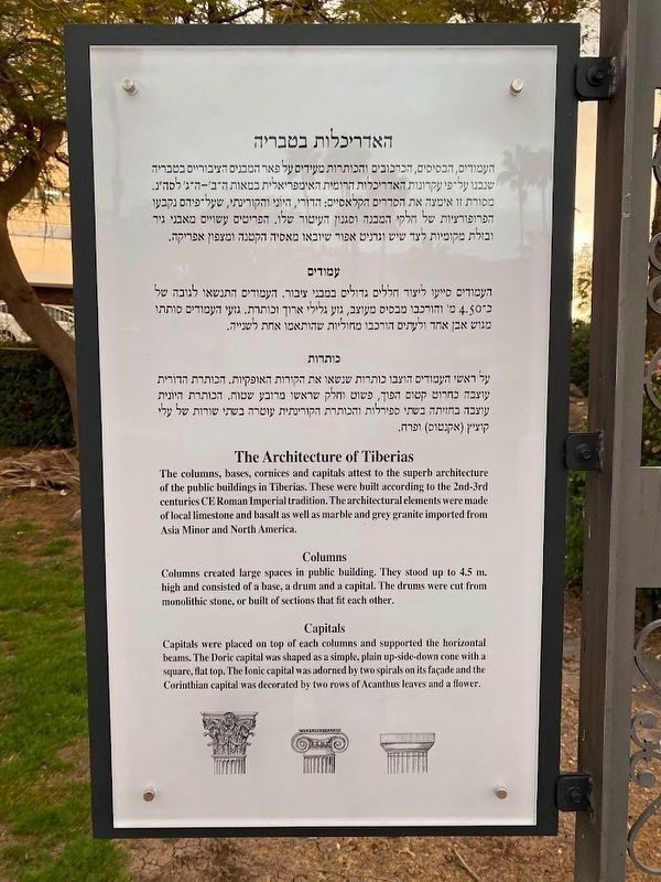
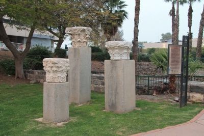
The Architecture of Tiberias
Erected by The municipality of Tiberias, Tourism Department.
Topics and series. This historical marker is listed in these topic lists: Architecture • Settlements & Settlers. In addition, it is included in the The Tiberias Archeological Park series list.
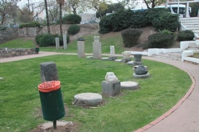
Location. 32° 47.155′ N, 35° 32.521′ E. Marker is in Tiberias, Northern District. Marker can be reached from HaBanim (National Route 90) just north of HaGalil, on the right when traveling north. This historical marker is located on the south side of the downtown Tiberias business district, affixed to an ornate pole, that is inside a small archaeological park situated directly in front (to the west) of the Leonardo Plaza Hotel. Touch for map. Touch for directions.
Other nearby markers. At least 8 other markers are within walking distance of this marker. Domestic Building (here, next to this marker); The Synagogue (a few steps from this marker); Doors of Burial Caves / Burial Customs - Sarcophagi (within shouting distance of this marker); "Magic on the sea of galilee..." (within shouting distance of this marker); The Crusader-Ottoman Building / Millstones (within shouting distance of this marker); The Southern Wall (about 120 meters away, measured in a direct line); Remains of the Watch Tower (approx. 0.3 kilometers away); Liberation of Tiberias Memorial (approx. 0.4 kilometers away). Touch for a list and map of all markers in Tiberias.
Regarding The Architecture of Tiberias. On 5/16/2013 I sent an e-mail to the Tiberias municipality Foreign Affairs Office web site, calling their attention to the statement of historical fact, on the text of this historical marker, that makes the claim that marble and grey granite were imported from both Asia Minor and North America. Since I am not aware of the Roman Empire ever having established trade and commerce with any part of North America I am guessing that there was an error in translating the original Hebrew text into English and that perhaps it was intended to state that the stone was imported from north Armenia rather than North America, but I am no expert on such matters and can only speculate. Other than this issue, all of the historical markers at the Tiberias Archeological Park were very informative and I thoroughly enjoyed my historical tour of the park and of the area around Tiberias.
Also see . . . Tiberias. This is a link to information provided by Wikipedia, the free encyclopedia. (Submitted on May 16, 2013, by Dale K. Benington of Toledo, Ohio.)
Credits. This page was last revised on May 7, 2023. It was originally submitted on May 15, 2013, by Dale K. Benington of Toledo, Ohio. This page has been viewed 534 times since then and 13 times this year. Photos: 1. submitted on April 28, 2023, by Darren Jefferson Clay of Duluth, Georgia. 2, 3, 4, 5. submitted on May 16, 2013, by Dale K. Benington of Toledo, Ohio.
