Near Howell in Ford County, Kansas — The American Midwest (Upper Plains)
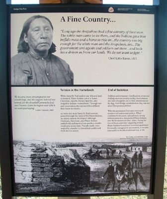
A Fine Country…
"Long ago the Arapahoes had a fine country of their own. The white man came to see them, and the Indians gave him buffalo meat and a horse to ride on…the country was big enough for the white man and the Arapahoes, too…The government sent agents and soldiers out there…and both have driven us from our lands. We do not want to fight."
Chief Little Raven, 1871
We became more circumspect in our wanderings, and the wagons loitered not behind; for the dreaded Camanche and Pawnee claim the region over which we were journeying.
Lewis Garrard, 1847
Tension in the Homelands
While Santa Fe Trail traders saw this arid land as isolated, Plains Indians saw it as home. Cheyenne, Apache, Kiowa-Apaches, and Arapahoe Indians roamed here. Through war and cooperation, the various tribes defined their home territories.
As more and more Santa Fe Trail travelers passed through the lands of the Plains Indians, an uneasy tension developed. Although Mexicans, Americans, and Plains Indians traded with and married one another, trouble could arise at any time. Friendly trade, wary suspicion, plunder, or bloodshed could result from any encounter.
End of Isolation
Soldiers and temporary fortifications protected trading caravans as early as 1847, but isolation and lack of supplies led to their abandonment by 1854. Fort Dodge, established in 1865, was the area's first permanent fort.
With the permanent fort came increased numbers of traders and settlers. When combined with a new railroad and a strong military presence, this pushed Plains Indians into the territories of other tribes. Facing the loss of bison and other migrating wildlife, Plains Indians found their survival jeopardized. Eventually consigned to reservations, it became impossible to live the traditional way of life.
[Bottom background photo caption reads] Fort Dodge was established in 1865. Sketch by Theodore Davis for Harper's Weekly. Courtesy of Boot Hill Museum.
Erected by the National Park Service, Boot Hill Museum, and Santa Fe Trail Association.
Topics and series. This historical marker is listed in these topic lists: Forts and Castles • Native Americans • Roads & Vehicles • Settlements & Settlers. In addition, it is included in the Santa Fe Trail series list. A significant historical year for this entry is 1871.
Location. 37° 47.387′ N, 100° 11.828′ W. Marker is near Howell, Kansas, in Ford County. Trail Ruts Park is on the right while traveling west of US Hwy 50/400, about ½ mile west of Howell Road. Touch for map. Marker is in this post office area: Dodge City KS 67801, United States of America. Touch for directions.
Other nearby markers. At least
8 other markers are within walking distance of this marker. Trails on the Prairie (here, next to this marker); Santa Fe Trail Sites to the West & South (here, next to this marker); Santa Fe Trail, 1821 - 1880 (here, next to this marker); Santa Fe Trail Sites to the East (here, next to this marker); Campsite of the U.S. Survey Team Sept. 10-21, 1825 (within shouting distance of this marker); a different marker also named Santa Fe Trail (within shouting distance of this marker); The Worst Piece of Road (about 400 feet away, measured in a direct line); Santa Fe Trail Remains (about 500 feet away). Touch for a list and map of all markers in Howell.
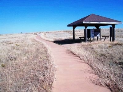
More about this marker. Marker is in a kiosk along the walking path.
Also see . . .
1. Santa Fe National Historic Trail. (Submitted on May 26, 2013, by William Fischer, Jr. of Scranton, Pennsylvania.)
2. Santa Fe Trail Association. (Submitted on May 26, 2013, by William Fischer, Jr. of Scranton, Pennsylvania.)
Additional keywords. Genocide, Forced Removal
Credits. This page was last revised on September 2, 2020. It was originally submitted on May 25, 2013, by William Fischer, Jr. of Scranton, Pennsylvania. This page has been viewed 479 times since then and 4 times this year. Photos: 1, 2. submitted on May 26, 2013, by William Fischer, Jr. of Scranton, Pennsylvania.

