Near Luthersburg in Clearfield County, Pennsylvania — The American Northeast (Mid-Atlantic)
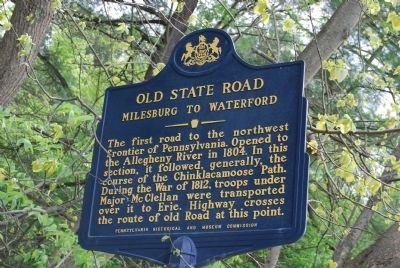
Old State Road
Milesburg to Waterford
Erected 1955 by Pennsylvania Historical and Museum Commission.
Topics and series. This historical marker is listed in this topic list: Roads & Vehicles. In addition, it is included in the Pennsylvania Historical and Museum Commission series list. A significant historical year for this entry is 1804.
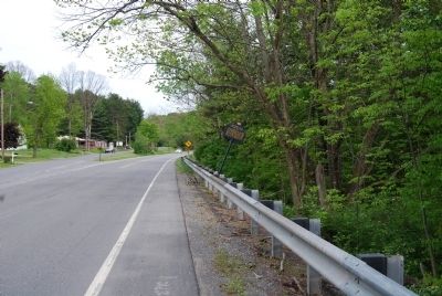
Location. 41° 5.338′ N, 78° 48.062′ W. Marker is near Luthersburg, Pennsylvania, in Clearfield County. Marker is at the intersection of Twenty-eighth Division Highway (U.S. 322) and Thunderbird Road, on the right when traveling east on Twenty-eighth Division Highway. Touch for map. Marker is in this post office area: Du Bois PA 15801, United States of America. Touch for directions.
Other nearby markers. At least 8 other markers are within 11 miles of this marker, measured as the crow flies. DuBois (approx. 4.3 miles away); Union Soldiers & Sailors Memorial (approx. 4˝ miles away); The Big Spring (approx. 4.8 miles away); This Tablet Marks the Junction (approx. 5 miles away); Richard H. Burfoot (approx. 5˝ miles away); Discover Elk Scenic Drive (approx. 8.8 miles away); First Pennsylvania Troopers Killed in the Line of Duty (approx. 9.9 miles away); Snowshoe/Packersville Turnpike (approx. 10.3 miles away). Touch for a list and map of all markers in Luthersburg.
Credits. This page was last revised on June 16, 2016. It was originally submitted on May 28, 2013, by Mike Wintermantel of Pittsburgh, Pennsylvania. This page has been viewed 863 times since then and 43 times this year. Photos: 1, 2. submitted on May 28, 2013, by Mike Wintermantel of Pittsburgh, Pennsylvania.

