College Township near State College in Centre County, Pennsylvania — The American Northeast (Mid-Atlantic)
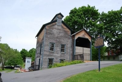
John I. Thompson Grain Elevator and Coal Sheds
Inscription.
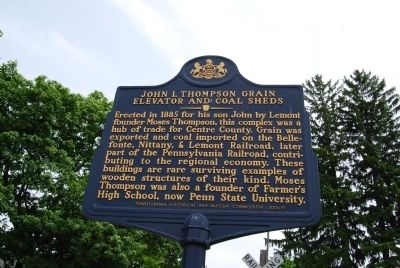
Erected in 1885 for his son John by Lemont founder Moses Thompson, this complex was a hub of trade for Centre County. Grain was exported and coal imported on the Belle- fonte, Nittany, & Lemont Railroad, later part of the Pennsylvania Railroad, contri- buting to the regional economy. These buildings are rare surviving examples of wooden structures of their kind. Moses Thompson was also a founder of Farmer's High School, now Penn State University.
Erected 2006 by Pennsylvania Historical and Museum Commission.
Topics and series. This historical marker is listed in these topic lists: Agriculture • Education • Industry & Commerce • Railroads & Streetcars. In addition, it is included in the Pennsylvania Historical and Museum Commission, and the Pennsylvania State University series lists. A significant historical year for this entry is 1885.
Location. 40° 48.618′ N, 77° 49.038′ W. Marker is near State College, Pennsylvania, in Centre County. It is in College Township. Marker is at the intersection of Mt. Nittany Road and Mulberry Lane, on the right when traveling east on Mt. Nittany Road. Touch for map. Marker is at or near this postal address: 123 Mount Nittany Rd, Lemont PA 16851, United States of America. Touch for directions.
Other nearby markers. At least 8 other markers are within 2 miles of this marker, measured as the crow flies . Centre Furnace Mansion (approx. 1.3 miles away); Tree and Shrub Border (approx. 1.3 miles away); American Sycamore (approx. 1.3 miles away); Centre Furnace Forges a Community (approx. 1.3 miles away); Moses Thompson (approx. 1.4 miles away); The Gardeners Garden (approx. 1.4 miles away); Centre Furnace (approx. 1.4 miles away); Path of a Historic Waterway (approx. 1.4 miles away). Touch for a list and map of all markers in State College.
Credits. This page was last revised on February 7, 2023. It was originally submitted on May 29, 2013, by Mike Wintermantel of Pittsburgh, Pennsylvania. This page has been viewed 499 times since then and 15 times this year. Photos: 1, 2. submitted on May 29, 2013, by Mike Wintermantel of Pittsburgh, Pennsylvania.

