Miami in Miami-Dade County, Florida — The American South (South Atlantic)
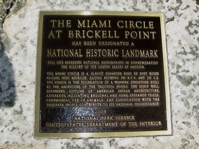
The Miami Circle at Brickell Point
at Brickell Point
has been designated a
National Historic Landmark
This site possesses national significance in commemorating the history of the United States of America.
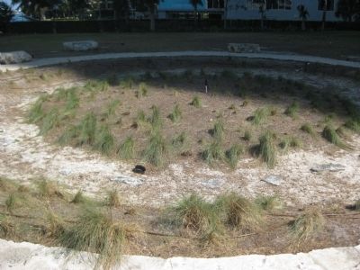
The Miami Circle is a 38-foot diameter ring of post holes carved into bedrock, dating between 500 B.C.E. and 750 C.E. The circle is the foundation of a wooden structure built by the ancestors of the Tequesta people. The site's well-preserved outline of American Indian architecture, artifacts indicating regional and long-distance trade, ceremonial use of animals, and association with the Tequesta people contribute to its national significance.
Erected 2009 by the National Park Service and the United States Department of the Interior.
Topics and series. This historical marker is listed in these topic lists: Anthropology & Archaeology • Native Americans • Settlements & Settlers. In addition, it is included in the National Historic Landmarks series list.
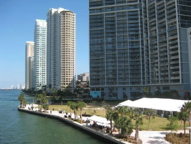
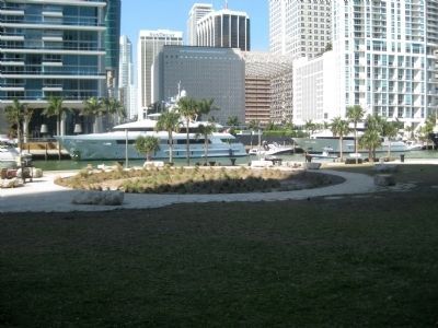
Location. 25° 46.166′ N, 80° 11.373′ W. Marker is in Miami, Florida, in Miami-Dade County. Marker can be reached from Brickell Avenue (U.S. 1/41) north of Southeast 5th Street, on the right when traveling north. The Miami Circle site is operated as a park in Miami's Brickell neighborhood, across from downtown along the south bank of the Miami River. Also known as Brickell Point, the site sits at the mouth of the river, where it empties into Biscayne Bay. The park (not to be confused with Brickell Park, roughly 500 feet to the south) is a short walk east of Fifth Street Station along the Metromover's Brickell loop. Touch for map. Marker is at or near this postal address: 401 Brickell Avenue, Miami FL 33131, United States of America. Touch for directions.
Other nearby markers. At least 8 other markers are within walking distance of this marker. The People of Brickell Point (a few steps from this marker); The Miami Circle (within shouting distance of this marker); Saving the Circle (about 300 feet away, measured in a direct line); Mary Brickell Park (about 500 feet away); Brickell Park (about 500 feet away); Menendez on Biscayne Bay (approx. half a mile away); Dade County (approx. half a mile away); Gesu Catholic Church (approx. half a mile away). Touch for a list and map of all markers in Miami.
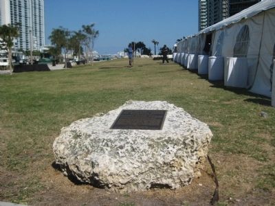
More about this marker. The marker is laid atop a block of limestone at the park's west side, near the circular drive, and several hundred feet west of the Miami Circle formation.
Regarding The Miami Circle at Brickell Point. Discovered in 1998, the Miami Circle is a 38 ft (11.5 m) diameter circle of 24 post holes cut almost two feet into the limestone bedrock, with several additional holes outside the circular group. The ancient building foundation is the only known evidence of a prehistoric permanent structure cut into the bedrock in the United States. The site contained as well numerous ancient artifacts, such as ceramics, stone axes and other tools carved from bone and shells, and animal remains. Prior to its designation as a National Historic Landmark, the site was listed with the National Register of Historic Places in 2002 (refrence #01001534).
Before 1998 six low-rise apartment buildings from the 1950s had occupied the site. When those structures were razed in order to erect a high-rise condominium complex, city codes required a routine archaeological field study be done. The unexpected discovery resulting from that study made the site a center of controversy for years to follow. The owner, eager to begin construction, saw his plans stymied as preservationists and community leaders lobbied their governments to intervene and save the circle from destruction. Ultimately, the State of Florida and Miami-Dade County were able to jointly purchase the site from the developer, though the deal would cost a total of $26.7 million.
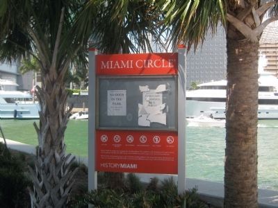
In 2011, the site was opened as a public park and managed by a local historical institute, HistoryMiami.
Related markers.
Click here for a list of markers that are related to this marker. These markers explain the history of the Miami Circle and Brickell Point.
Also see . . .
1. Miami Circle. article on Wikipedia (Submitted on April 14, 2013, by Glenn Sheffield of Tampa, Florida.)
2. Archaeology Projects: Miami Circle. Virtual tour and overview from the Florida Department of State (Submitted on April 14, 2013, by Glenn Sheffield of Tampa, Florida.)
3. Tequesta. Wikipedia article on the Native American tribe (Submitted on April 14, 2013, by Glenn Sheffield of Tampa, Florida.)
Photographed By AGS Media, March 16, 2013
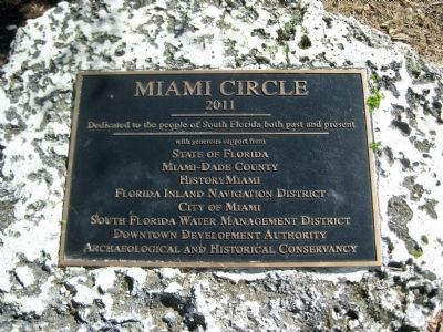
7. Miami Circle Park Dedication Plaque
2011
Dedicated to the people of South Florida both past and present
with generous support from
State of Florida
Miami-Dade County
HistoryMiami
Florida Inland Navigation District
City of Miami
South Florida Water Management District
Downtown Development Authority
Archaeological and Historical Conservancy
Credits. This page was last revised on December 4, 2023. It was originally submitted on April 14, 2013, by Glenn Sheffield of Tampa, Florida. This page has been viewed 1,189 times since then and 79 times this year. Last updated on May 31, 2013, by Glenn Sheffield of Tampa, Florida. Photos: 1, 2, 3, 4, 5, 6, 7. submitted on April 14, 2013, by Glenn Sheffield of Tampa, Florida. • Bill Pfingsten was the editor who published this page.
