Lonoke in Lonoke County, Arkansas — The American South (West South Central)
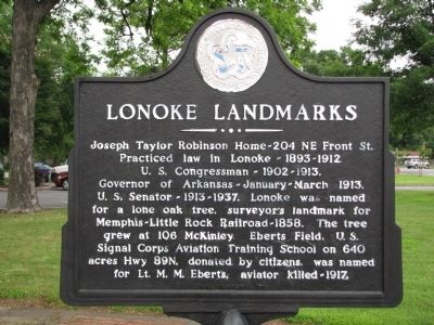
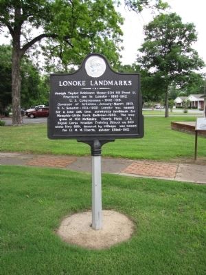
Lonoke Landmarks
Joseph Taylor Robinson Home - 204 NE Front St.
Practiced law in Lonoke - 1893-1912
U.S. Congressman - 1902-1913.
Governor of Arkansas - January - March 1913.
U.S. Senator - 1913-1937. Lonoke was named for lone oak tree, surveyor's landmark for Memphis-Little Rock Railroad - 1858. The tree grew at 106 McKinley.
Eberts Field, U.S.Signal Corps Aviation Training School on 640 acres Hwy 89N, donated by citizens, was named for Lt. M.M. Eberts, aviator killed - 1917.
Erected 1976 by Lonoke Bicentennial.
Topics and series. This historical marker is listed in these topic lists: Government & Politics • Railroads & Streetcars • Settlements & Settlers. In addition, it is included in the The Spirit of ’76, America’s Bicentennial Celebration series list. A significant historical month for this entry is March 1913.
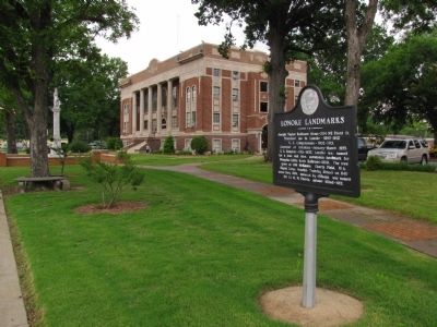
Location. 34° 47.131′ N, 91° 53.995′ W. Marker is in Lonoke, Arkansas, in Lonoke County. Marker is on North Center Street (State Highway 31) north of 2nd Street, on the right when traveling north. Marker is located near the southwest corner of the Lonoke County Courthouse grounds. Touch for map. Marker is in this post office area: Lonoke AR 72086, United States of America. Touch for directions.
Other nearby markers. At least 8 other markers are within 3 miles of this marker, measured as the crow flies. Lonoke County Confederate Monument (a few steps from this marker); A Gun for All Reasons (within shouting distance of this marker); Senator Joe T. Robinson (within shouting distance of this marker); Lonoke County Honor Roll (about 400 feet away, measured in a direct line); The Lonoke Depot (about 600 feet away); Eberts Air Field (approx. 0.2 miles away); Hicks' Station in the Civil War (approx. 1˝ miles away); Battle of Brownsville (approx. 2.4 miles away). Touch for a list and map of all markers in Lonoke.
Credits. This page was last revised on October 16, 2020. It was originally submitted on June 6, 2013, by Lee Hattabaugh of Capshaw, Alabama. This page has been viewed 783 times since then and 36 times this year. Photos: 1, 2, 3. submitted on June 6, 2013, by Lee Hattabaugh of Capshaw, Alabama. • Bill Pfingsten was the editor who published this page.


