Critz in Patrick County, Virginia — The American South (Mid-Atlantic)
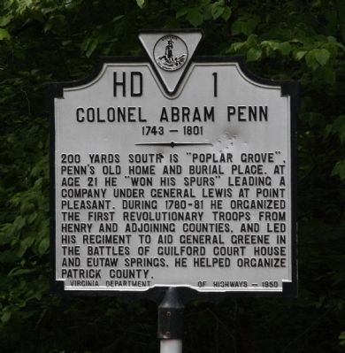
Colonel Abram Penn
1743–1801
200 yards south is “Poplar Grove,” Penn’s old home and burial place. At age 21 he “won his spurs” leading a company under General Lewis at Point Pleasant. During 1780–81 he organized the first Revolutionary troops from Henry and adjoining counties, and led his regiment to aid General Greene in the battles of Guilford Court House and Eutaw Springs. He helped organize Patrick County.
Erected 1950 by Virginia Department of Highways. (Marker Number HD-1.)
Topics and series. This historical marker is listed in this topic list: War, US Revolutionary. In addition, it is included in the Virginia Department of Historic Resources (DHR) series list.
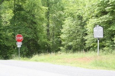
Location. 36° 40.941′ N, 80° 5.495′ W. Marker is in Critz, Virginia, in Patrick County. Marker is at the intersection of Abram Penn Highway (County Route 626) and Kootes Mill Road (County Route 703), on the left when traveling north on Abram Penn Highway. Touch for map. Marker is in this post office area: Critz VA 24082, United States of America. Touch for directions.
Other nearby markers. At least 8 other markers are within 10 miles of this marker, measured as the crow flies. The Reynolds Homestead (approx. 4.2 miles away); Frontier Fort (approx. 5.8 miles away); a different marker also named Reynolds Homestead (approx. 6.8 miles away); The Historic John D. Bassett High School (approx. 7.7 miles away); Fairy Stone State Park (approx. 8.2 miles away); Waller's Ford (approx. 8.8 miles away); First Henry County Courthouse (approx. 8.8 miles away); Blue Ridge Mission School (approx. 9½ miles away). Touch for a list and map of all markers in Critz.
More about this marker. This is the only Virginia marker number in the “H” series. Abram Penn Highway was once a Virginia primary route, Route 105, but in 1942—coincidental with the abandonment of the Danville and Western Railway through Critz—it was downgraded to secondary route 626. Is this marker located where it was originally erected? Both Peter’s 1985 and Salmon’s 1994 guidebooks both locate the marker in in Patrick County on US 58 1.86 miles S.E. of the Henry County line, except that Patrick County is west of Henry County, so “southeast” does not make any sense because the county east of Henry on US 58 is Pittsylvania, not Patrick. Arnold’s 2007 guidebook agrees with its present location.
Also see . . . Abram Penn. Wikipedia entry (Submitted on February 25, 2022, by Larry Gertner of New York, New York.)
Credits. This page was last revised on February 25, 2022. It was originally submitted on June 9, 2013, by J. J. Prats of Powell, Ohio. This page has been viewed 699 times since then and 37 times this year. Photos: 1, 2. submitted on June 9, 2013, by J. J. Prats of Powell, Ohio.
Editor’s want-list for this marker. Photos of Poplar Grove and gravesite • Can you help?

