Danville, Virginia — The American South (Mid-Atlantic)
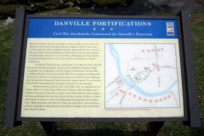
Danville Fortifications
Civil War Earthworks Constructed for Danville's Protection
Col. Robert Enoch Withers, commander of the Danville post, enlisted the aid of a Danville professor of music at the Methodist Female College to engineer the fortifications. Charles Chaky de Nordendorf had attended a military school in his native Prussia. With little engineering background, he laid out a system of earthworks that nearly encircled the town. Manned only during times of alarm by home guard and reserve forces, the earthworks were of little value except for the peace-of-mind of the townspeople.
Serious concerns arose in early April 1865, with the expected arrival of Gen. Robert E. Lee’s Army of Northern Virginia. The Confederate government relocated to Danville on April 3. President Jefferson Davis inspected these earthworks the next day and found them lacking. Soldiers, citizens and numerous slaves set about strengthening and expanding the fortifications. Work continued until April 10, when the government, after learning of Lee’s surrender at Appomattox Court House, boarded trains for Greensboro, North Carolina.
Erected by Virginia Civil War Trails.
Topics and series. This historical marker is listed in this topic list: War, US Civil. In addition, it is included in the Virginia Civil War Trails series list. A significant historical month for this entry is February 1863.
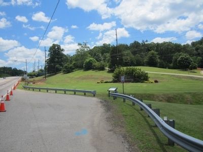
Location. 36° 35.197′ N, 79° 22.634′ W. Marker is in Danville, Virginia. Marker is at the intersection of South Boston Road (Business U.S. 58) and Old Halifax Road, on the left when traveling west on South Boston Road. Touch for map. Marker is in this post office area: Danville VA 24540, United States of America. Touch for directions.
Other nearby markers. At least 8 other markers are within walking distance of this marker. Richmond & Danville Railroad (approx. 0.4 miles away); a different marker also named Richmond & Danville Railroad (approx. 0.4 miles away); a different marker also named Richmond & Danville Railroad (approx. 0.4 miles away); Danville Rail Passenger Station (approx. 0.4 miles away); The Worsham Street Bridge (approx. 0.6 miles away); Danville Tobacco Warehouse and Residential District (approx. 0.7 miles away); Tobacco Heritage Mural (approx. 0.7 miles away); Confederate Prison No. 6 (approx. ¾ mile away). Touch for a list and map of all markers in Danville.
Credits. This page was last revised on February 2, 2023. It was originally submitted on June 16, 2013, by Bernard Fisher of Richmond, Virginia. This page has been viewed 1,080 times since then and 24 times this year. Photos: 1, 2. submitted on June 16, 2013, by Bernard Fisher of Richmond, Virginia.

