Near Sharpsburg in Washington County, Maryland — The American Northeast (Mid-Atlantic)
Longstreet's Command
Kemper's Brigade, D.R. Jones' Division
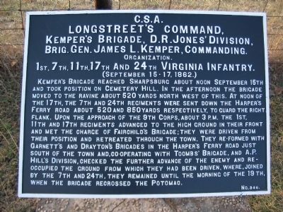
Longstreet's Command.
Kemper's Brigade, D.R. Jones' Division,
Brig. Gen. James L. Kemper, Commanding.
Organization.
1st, 7th, 11th, 17th and 24th Virginia Infantry.
(September 15-17, 1862.)
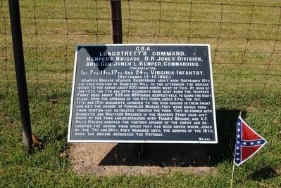
Kemper's Brigade reached Sharpsburg about noon September 15th and took position on Cemetery Hill. In the afternoon the Brigade moved to the ravine about 520 yards north west of this. At noon of the 17th, the 7th and 24th regiments were sent down the Harper's Ferry road about 520 and 850 yards respectively, to guard the right flank. Upon the approach of the 9th Corps, about 3 p.m. the 1st, 11th and 17th regiments advanced to the high ground in their front and met the charge of Fairchild's Brigade; They were driven from their position and retreated through the town. They re-formed with Garnett's and Drayton's Brigades in the Harper's Ferry Road just south of the town and, co-operating with Toomb's Brigade, and A.P. Hill's Division, checked the further advance of the enemy and reoccupied the ground from which they had been driven, where, joined by the 7th and 24th, they remained until the morning of the 19th, when the brigade recrossed the Potomac.
Erected by Antietam Battlefield Board. (Marker Number 346.)
Topics and series. This historical marker is listed in this topic list: War, US Civil. In addition, it is included in the Antietam Campaign War Department Markers series list. A significant historical date for this entry is September 17, 1862.
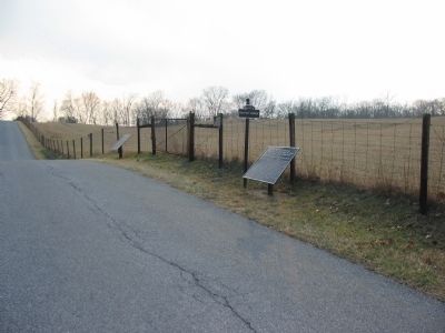
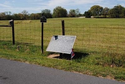
Location. 39° 27.133′ N, 77° 44.381′ W. Marker is near Sharpsburg, Maryland, in Washington County. Marker is on Branch Avenue, on the right when traveling south. Touch for map. Marker is in this post office area: Sharpsburg MD 21782, United States of America. Touch for directions.
Other nearby markers. At least 10 other markers are within walking distance of this marker. Wise (Virginia) Artillery (a few steps from this marker); Kanawha Division, Ninth Corps (within shouting distance of this marker); Ninth Army Corps (about 300 feet away, measured in a direct line); 28th Ohio Volunteer Infantry (about 300 feet away); a different marker also named Ninth Army Corps (about 300 feet away); a different marker also named Longstreet's Command (about 400 feet away); 51st Pennsylvania Volunteer Infantry (about 400 feet away); D.R. Jones' Division, Longstreet's Command (about 400 feet away); a different marker also named D.R. Jones' Division, Longstreet's Command (about 400 feet away); a different marker also named Ninth Army Corps (about 400 feet away). Touch for a list and map of all markers in Sharpsburg.
Related markers. Click here for a list of markers that are related to this marker. Follow Kemper's Brigade by tablets.
Also see . . .
1. Antietam Battlefield. National Park Service site. (Submitted on March 25, 2008, by Craig Swain of Leesburg, Virginia.)
2. Kemper's Brigade, D.R. Jones' Division. Before the war, Kemper was a politician holding state office. After the war he served a time as state governor. (Submitted on March 25, 2008, by Craig Swain of Leesburg, Virginia.)
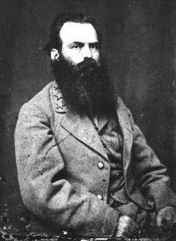
3. James L. Kemper. James Lawson Kemper (June 11, 1823 – April 7, 1895) was a lawyer, a Confederate general in the American Civil War, and the 37th Governor of Virginia. He was the youngest of the brigade commanders, and the only non-professional military officer, in the division that led Pickett's Charge, in which he was wounded and captured but rescued. (Submitted on October 10, 2015, by Brian Scott of Anderson, South Carolina.)
Photographed By Brian Scott
5. Major General James L. Kemper (1823-1895)
At the Battle of Antietam he was south of the town of Sharpsburg, defending against Maj. Gen. Ambrose E. Burnside's assault in the afternoon of September 17, 1862. He withdrew his brigade in the face of the Union advance, exposing the Confederate right flank, and the line was saved only by the hasty arrival of A.P. Hill's division from Harpers Ferry.
Photographed By Craig Swain, February 9, 2008
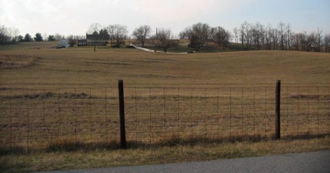
6. Kemper's Position
Looking west from near the tablet location. Kemper's Brigade, minus the 7th and 24th Regiments posted further south, occupied the high ground across the field. The Wise Artillery fell back to a position in front of the modern house when the IX Corps advanced. A point of reference in this photo is the 9th New York Volunteers Monument spire on the center horizon.
Credits. This page was last revised on November 24, 2017. It was originally submitted on March 25, 2008, by Craig Swain of Leesburg, Virginia. This page has been viewed 777 times since then and 14 times this year. Photos: 1. submitted on March 25, 2008, by Craig Swain of Leesburg, Virginia. 2. submitted on October 10, 2015, by Brian Scott of Anderson, South Carolina. 3. submitted on March 25, 2008, by Craig Swain of Leesburg, Virginia. 4, 5. submitted on October 10, 2015, by Brian Scott of Anderson, South Carolina. 6. submitted on March 25, 2008, by Craig Swain of Leesburg, Virginia.
