Providence in Halifax County, Virginia — The American South (Mid-Atlantic)
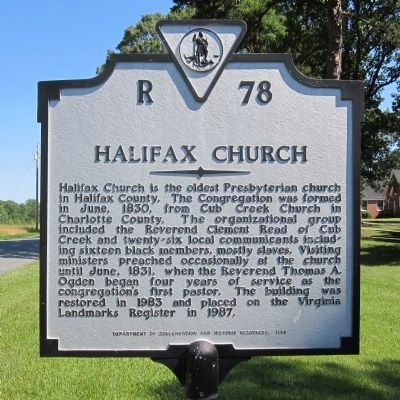
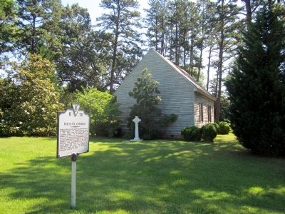
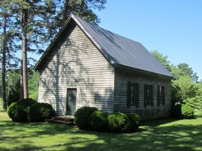
Halifax Church
Erected 1988 by Department of Conservation and Historic Resources. (Marker Number R-78.)
Topics and series. This historical marker is listed in this topic list: Churches & Religion. In addition, it is included in the Virginia Department of Historic Resources (DHR) series list. A significant historical month for this entry is June 1830.
Location. 36° 56.266′ N, 78° 49.183′ W. Marker is in Providence, Virginia, in Halifax County. Marker is at the intersection of Cole Ferry Road (Virginia Route 624) and Morton's Ferry Road (Virginia Route 623), on the right when traveling north on Cole Ferry Road. Touch for map. Marker is in this post office area: Nathalie VA 24577, United States of America. Touch for directions.
Other nearby markers. At least 8 other markers are within 8 miles of this marker, measured as the crow flies. Clarkton Bridge (approx. 5.1 miles away); Wilson’s orders were to destroy the Richmond and Danville Railroad to the greatest extent possible (approx. 7.4 miles away); Roanoke Station (approx. 7.4 miles away); Wilson-Kautz Raid (approx. 7.4 miles away); The Battle of Staunton River Bridge (approx. 7.6 miles away); Red Hill Scatter Garden (approx. 7.7 miles away); Red Hill Plantation (approx. 7.8 miles away); Slave Cabin (approx. 7.8 miles away).
Credits. This page was last revised on June 16, 2016. It was originally submitted on June 16, 2013, by Bernard Fisher of Richmond, Virginia. This page has been viewed 311 times since then and 12 times this year. Photos: 1, 2, 3. submitted on June 16, 2013, by Bernard Fisher of Richmond, Virginia.


