Danville, Virginia — The American South (Mid-Atlantic)
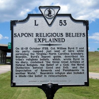
Saponi Religious Beliefs Explained
Erected 1987 by Department of Conservation and Historic Resources. (Marker Number L-53.)
Topics and series. This historical marker is listed in these topic lists: Churches & Religion • Colonial Era • Exploration • Native Americans. In addition, it is included in the Virginia Department of Historic Resources (DHR) series list. A significant historical year for this entry is 1728.
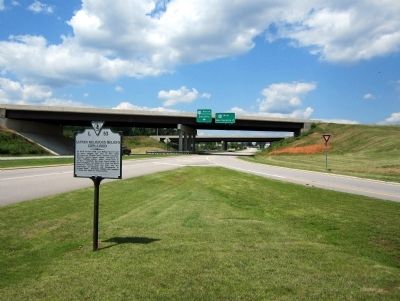
Location. Marker has been reported missing. It was located near 36° 32.458′ N, 79° 27.922′ W. Marker was in Danville, Virginia. Marker was at the intersection of U.S. 29 and Danville Expressway (U.S. 58), on the right when traveling north on U.S. 29. Touch for map. Marker was in this post office area: Danville VA 24541, United States of America. Touch for directions.
Other nearby markers. At least 8 other markers are within 4 miles of this location, measured as the crow flies. Rockabilly Pioneer Janis Martin (approx. 1.2 miles away); Schoolfield (approx. 3 miles away); Washington's Southern Tour (approx. 3.8 miles away in North Carolina); Averett University (approx. 3.9 miles away); World War I Memorial (approx. 4.1 miles away); Veterans Memorial (approx. 4.1 miles away); The A.J. Montague House (approx. 4.1 miles away); Andrew Jackson Montague (approx. 4.1 miles away). Touch for a list and map of all markers in Danville.
Credits. This page was last revised on February 2, 2023. It was originally submitted on June 16, 2013, by Bernard Fisher of Richmond, Virginia. This page has been viewed 1,073 times since then and 80 times this year. Photos: 1, 2. submitted on June 16, 2013, by Bernard Fisher of Richmond, Virginia.

